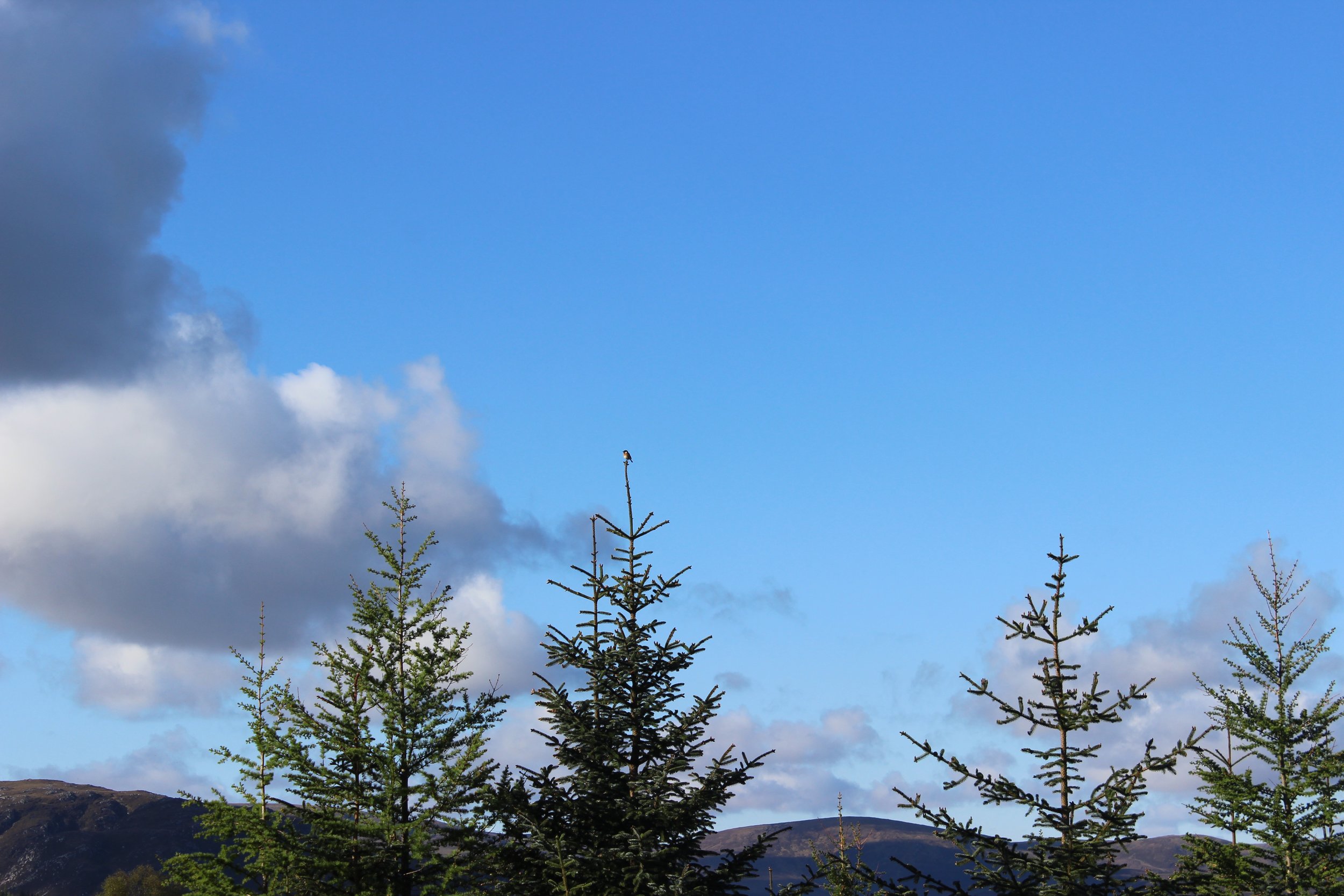
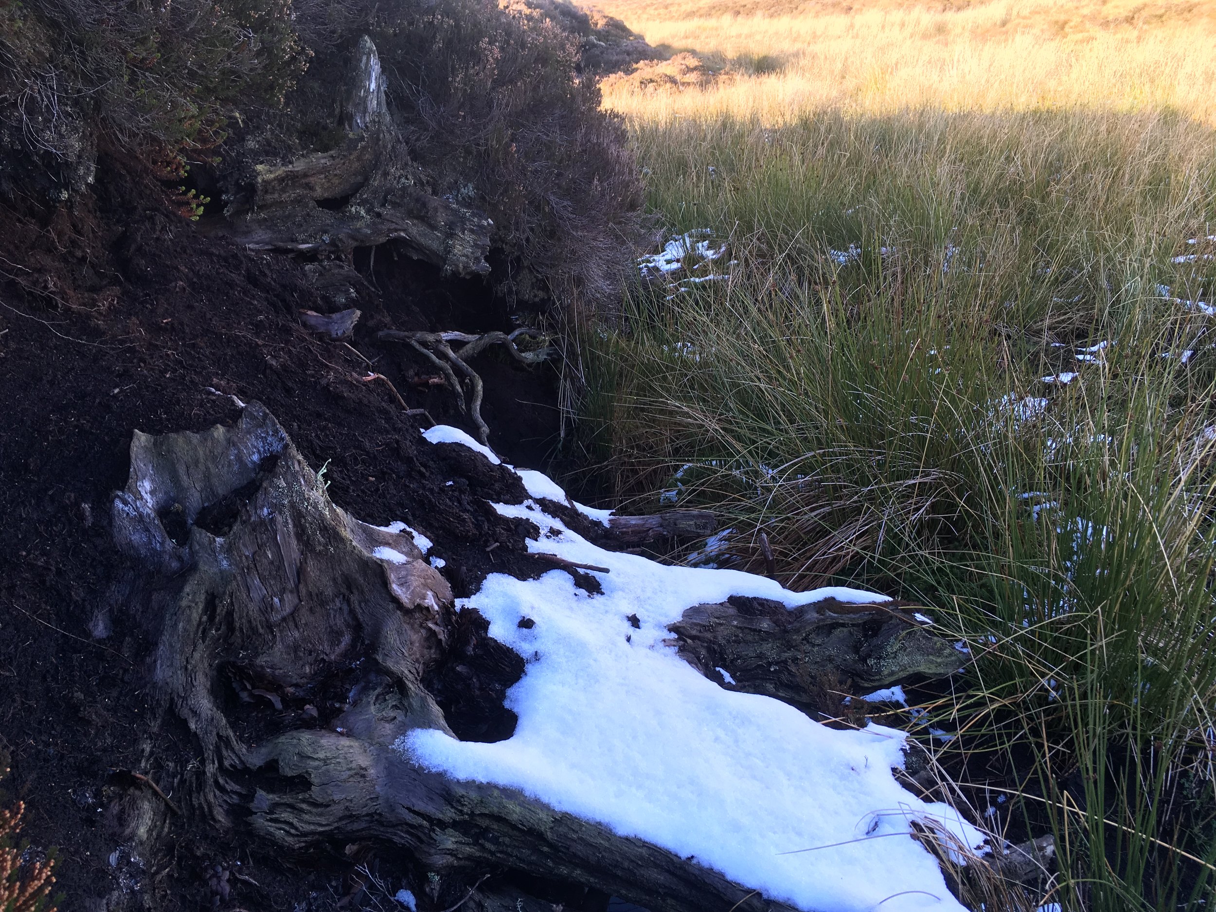
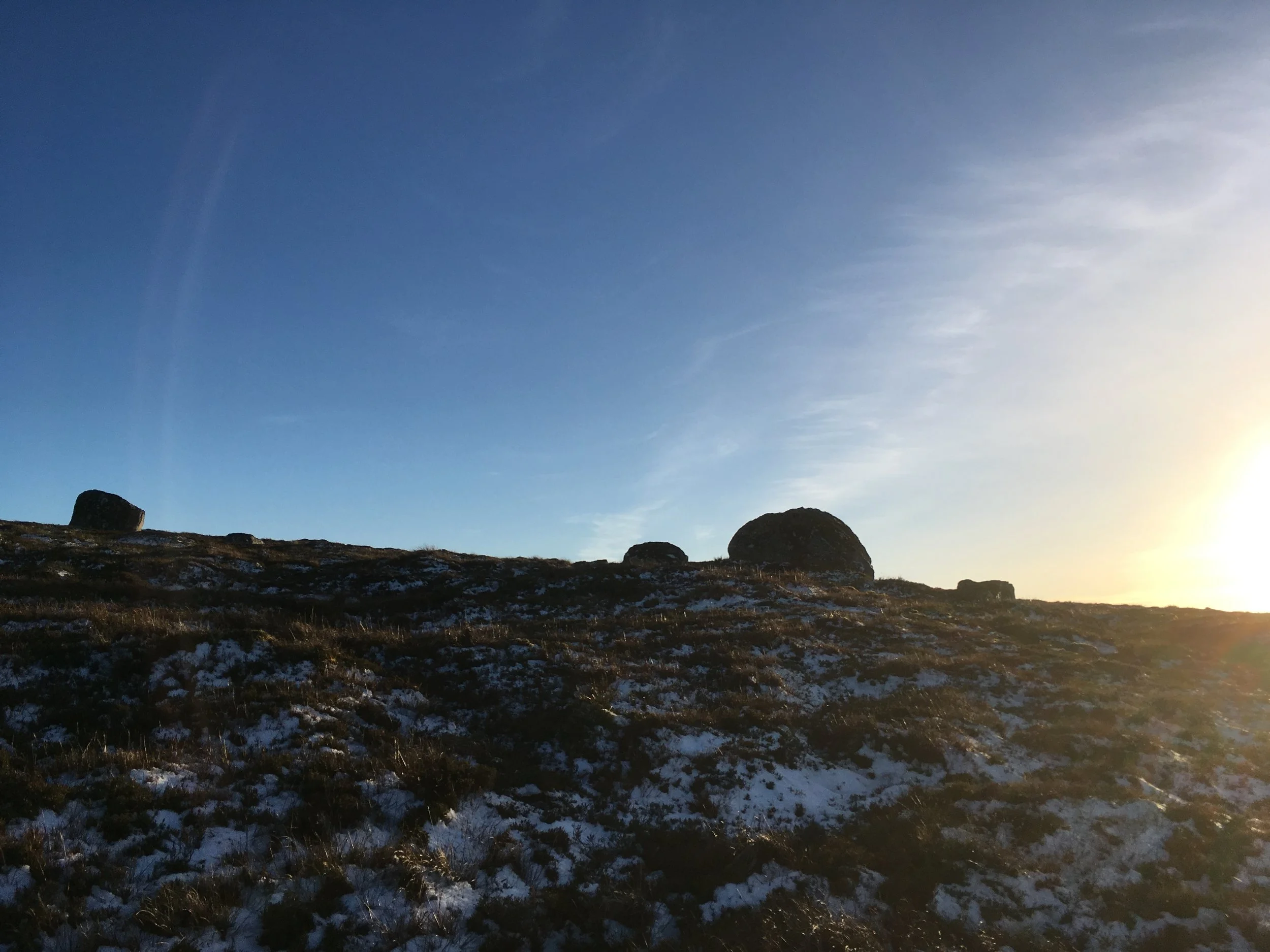
A' RUAMHAIR - AN TOBHTA AS FHAISGE OIRNN

English summary below -

Tha seann bhaile fearainn air cùl an taighe. Feumaidh tu slighe a ghabhail tron a’ mhòintich an-diugh gus a ruigheachd. ‘S e am Baile Dubh a b’ aimn dha (Baldoo gu h-ìosal).

Latha dha robh e, feumaidh gur e suidheachadh math a bh’aig a’ Bhaile Dhubh; faisg air an abhainn, le tobair, talamh còmhnard is beagan dìon on ghaoith ‘s e ann am fasgadh a’ chnuic.

Baile Dubh/ ‘Baldoo’ is na seann slighean ann

Baile Dubh/ ‘Baldoo’ is na seann slighean ann

Tha a’ chlann measail air a bhith a’ cluich ann. A’ chiad latha a chaidh sinn ann, thug sinn linn pàipear is peansail is camera. Thog sinn na dealbhan seo is rinn an tè bheag mapa de na tobhtaichean.

IMG_9086.jpg
IMG_9113.jpg
IMG_9126.jpg
a’ tilleadh bhon a bhith a’ plubadaich san abhainn

a’ tilleadh bhon a bhith a’ plubadaich san abhainn

IMG_9127.jpg
bùth

bùth

mapa

mapa

spàigearan beag a’ sreap nan creag

spàigearan beag a’ sreap nan creag

latha eile a’ cluich ann

latha eile a’ cluich ann

Cuairt gu Gleann Fireachan

Latha eile as t-samhradh ghabh sinn cuairt a Ghleann Fireachan. B’ e seo baile fearann eile, mu mhìle gu deas air a’ Bhaile Dhubh. Chì thu bàthach ann fhathast bhon rathad chùil faisg air Tòrr Darraich. Gun fhiosda dhuinn aig an àm, bha ceangal eadar na daoine a bha uair san dà àite seo.

IMG_9223.jpg
IMG_9224.jpg
CHUALA WIllie FORBES naidheachd aig an duine as leis an talamh an diugh, fear MAcCuithinn, gun deach am bàthach a thogail ‘s nach robh airgead aige airson an taigh an uair sin.

CHUALA WIllie FORBES naidheachd aig an duine as leis an talamh an diugh, fear MAcCuithinn, gun deach am bàthach a thogail ‘s nach robh airgead aige airson an taigh an uair sin.

IMG_9240.jpg
caob de mhullach sgràtha

caob de mhullach sgràtha

Gleann Fireachan - bho Fireach: upper slope, high ground (usually barren) / barren ground (Faclair Beag/ Dwelly)

Gleann Fireachan - bho Fireach: upper slope, high ground (usually barren) / barren ground (Faclair Beag/ Dwelly)

Beartas - bog a’ mhonaidh, canach, còinneach, fraoch, buidheagan is balgain-bhuachair.

Beartas - bog a’ mhonaidh, canach, còinneach, fraoch, buidheagan is balgain-bhuachair.

Tha clàraidhean aig Tobair an Dualchais do fhear, Finlay Smith a bh’ann an Ach Bhainnearan (Achvaneran) is a bhean Jessie a’ bruidhinn ris an t-Ollamh Nicolaisen mu ainmean àite na sgìre seo. Thug iad luaidh air a’ Bhaile Dhubh seo  (clàr 1; 16.20-50) ag ràdh gun robh seann bhodach, treabhaiche pòsda ‘s a theaghlach, a’ fuireach ann ri chiad chuimhne. Nam b’ urrainn dhuinn ainm a lorg, bhiodh sin againn co-dhiù.

Dh’iarr mi air nàbaidh dhomh, Anna Nic Dhòmhnaill, tè a tha eòlach air obair sloinntireachd, mo chuideachadh gus ainm a lorg. Bha beagan tàire aice leis mar a chaidh ‘Blackton‘ a thoirt air anns a’ chunntas ann an 1871 ach, co-dhiù, chaidh aic’ air.

‘S e Uilleam Mac na Clèirich ainm an duine. Phòs e Anna Nic an Tòisich à Gleann Fireachan ann an 1820.

Bha iad a’ fuireach anns a’ Bhaile Dhubh fad co-dhiù dà fhichead bliadhna. Tha e air ainmeachadh mar thuathanach le 10 acair is dà shearbhant anns na cunntaisean-sluaigh. Anns a’ Bhaile Dhubh air a’ chunntas sluaigh mu dheireadh anns a bheil luaidh air an t-àite, ann an 1871, bha a mhac, Iain, a bean aigesan is dithis de na h-oighaichean.

Seo earann den sloinntearach a rinn Anna NicDhòmhnaill.

Adjustments.jpeg

Thàinig rud eile am bàrr, le bhith a’ cur cheistean air Willie Forbes mu na tobhtaichean seo; litir a chaidh a chur gu ruige a sheanmhair, Catherine Fhoirbheis (Nic an Tòisich) aig Beitheachan (Beachan). Bha an litir bho thè a rinn eilthireachd à Srath Narann à Sealainn Nuadh. Dh’fhàg Grace Nic an Tòisich ‘s a teaghlach uile (a h-athair, a màthair, 4 bràithrean is 2 phiuthair) Gleann Fireachan ‘s gabh iad a-null gu ruige North Island ann an 1885. Bha i 18 nuair a dh’ fhàg i.

Bha talamh torrach aca an sin is an tuathanas fhèin. ‘S an litir tha i a’ bruidhinn air a bhàrr a tha air abachadh, prìs na clòimhe is ìm is feur. Ann an Srath Narann, cha robh còir-ghabhaltais aca is talamh truagh an coimeas ris na fhuair iad thall.

Tha an ionndrainn a th’oirre airson àitichean a h-òige soilleir. Bha i ‘sna seachdadan nuair a sgrìobh i dhachaigh gu a co-ogha.

“Who is farming Achavaneran now, and Balnafoich? Oh dear now these names takes me back home again. I hope you don’t mind me asking you so many questions…. I suppose old granny Baldoo’s house is pulled down long ago it was away at the back of your place. ..”

Feumaidh gur i an ‘granny Baldoo’ seo, Anna Nic an Tòisich.

83977932_173289767212548_8928586866299502592_n.jpg
84072881_2429863973897690_694216274384781312_n.jpg
84269820_208778886960307_3300262207505301504_n.jpg
Nuair a chaidh mapa na suirbhidh ordanains seo a dhèanamh ann an 1900 (1905) bha ainm is na mullaich air falbh bho na toglaichean. Tha am Baile Dubh far a bheil ‘spring’ sgrìobhte.

Nuair a chaidh mapa na suirbhidh ordanains seo a dhèanamh ann an 1900 (1905) bha ainm is na mullaich air falbh bho na toglaichean. Tha am Baile Dubh far a bheil ‘spring’ sgrìobhte.

am fuaran

am fuaran

An raon fo luachair

An raon fo luachair


B’ fhiach na cuairtean, am bruidhinn is an ruamhair seo gus beagan de sgeul nan daoine ‘s am beatha làitheil a thuigsinn. Chan e làrach chudthromach a tha seo, cha tig luchd-tadhail, cha tèid sanasan a chur suas, ach tillidh sinne. ‘S e àite a th’ann a dh’innseas tomhais dhuinn mun t-strì a bhiodh aca a thighinn beò. Tha an raon fo luachair an diugh. Is toil leam na naidheachdan bheaga seo ‘s nach deach dad a sgioblachadh no a sguabadh às. Is dòcha gum faighnichd a’ chlann mu na daoine a bha ann uairegin, an nàbaidhean tro thìm, is gum faod mi beagan innse dhaibh. Seo pàirt de chruth na tìre aca - àite far am faigh macmeanmhna beagan saorsa, gabhaidh suathadh ann is streap air is dealbhan a tharraing is bothain a chluich. Dhùraig mi na h-ainmean a sgrìobhadh an seo ann an cànan na daoine bha seo. Am fear a dh’ eadar-theangaich Baldoo gu Blackton, ghabhadh e an t-iognadh!

Cha bu mhiste dhuinn tomhais de sheunadh, chan eil a seo ach sin.


Summary;

ROOTING ABOUT - OUR CLOSEST RUIN

The closest ruin to us is am Baile Dubh / Baldoo on the early OS map.

Its not an official heritage site but it is a quiet place that speaks of the past. It is a landscape and environment of survival - a heritage born of a struggle to maintain a life. This is a place of small and overlooked histories.

I have a poster on how to maintain local distinctiveness by the group Common Ground which I love. Two of their manifesto ideas are;

Reveal the past. Decay is an important process. Don’t tidy things up so much that the layers of history and that reclaimed by nature are obliterated - let continuity show.
Take the fingerprint of the place - forget words such as resource, site, customers and the public. Abstractions lead us a stray. Think and talk about places and people


The children like to play at Am Baile Dubh - we took photos and the wee one drew a map of the stones. Another day in the summer we went a walk out to Gleann Fireachan (diminutive form of fireach; hill, moor, high barren ground/ upper slope) another ruin a mile to the South of Am Baile Dubh. We didn’t know at the time but there was a link between the people who were once in these two places.

Tobair an Dualchais / Kist o Riches, the online archive of recordings from the School of Scottish Studies, have a recording of a Jimmy Fraser and his wife Jessie who were in Ach Bhainnearan (Achvaneran) (track 1, 16.10). In a conversation about place names with Professor Nicolaisen he mentions a married ploughman who was at Am Baile Dubh to his first memory. If there was a way to have his name, I’d like that and Anna MacDonald, a neighbour and genealogist helped me.

Uilleam Mac a’ Chlèirich (William Clark) and his wife Anna Nic an Tòisich (MacKintosh) originally from Gleann Fireachan lived and farmed 10 acres for 40 years. They married on the 4th of December 1820 and had one son, Iain/ John. When the last census was done that showed people living at Am Baile Dubh in 1871, Uilleam was there with his son, his son’s second wife and 2 of his grandchildren. The place was last inhabited between 1871 and 1874/5.

I spoke to Willie Forbes about this place. He said a cousin of his MacKintosh granny had sent a letter home from New Zealand which might be of interest. Grace MacKintosh was 18 when she and her family (her mother, father, four brothers and two sisters) left Gleann Fireachan in 1885. Here they had no security of tenure and poor land, there they owned their own farm and had better ground. She was in her 70s when she wrote to ask of ‘granny Baldoo’s place’. The ‘granny Baldoo’ mentioned by Grace in this letter of 1933 was Anna Nic an Tòisich of Gleann Fireachan.

I can tell the children a bit about their neighbours through time. They can clamber about and play there and maybe grasp something of the life folk had here. They are asking to go again when the better weather comes.

We’re none the worse for some enchantment, that’s all this is.

dithis de bhràithrean Grace, Aonghas is Iain Mac an tòisich. Bha an dealbh seo a-measg dealbhan a bh’aig athair Willie Forbes. a picture of two of Grace’s brothers, Angus and John Mackintosh. this picture was in Willie’s father’s photo album.

dithis de bhràithrean Grace, Aonghas is Iain Mac an tòisich. Bha an dealbh seo a-measg dealbhan a bh’aig athair Willie Forbes.

a picture of two of Grace’s brothers, Angus and John Mackintosh. this picture was in Willie’s father’s photo album.

CARN NA H-INNSEIG - THE NAME BEFORE

The original Gaelic name given to the old drove road that runs through the hills between Strathnairn and Strathdearn is the Càrn na h-Innseig. Most call it the ‘Garbole road’ today. It’s what fits on a sign-post perhaps. Garbole (Garbh Tholl) is over the other side, in Strathdearn proper.

Innseag can mean various things. Dwelly’s Gaelic dictionary gives;

Innseag -eig -an s. f. dim. of innis 2. isle in a river 3. detached field or pasture 4. tale 5. little patch of arable ground, as in hilly or wooded countries.

In her essay 'Roads, Railways and Bridges' Hilda Hesling, in the late 1990s, mentions the simple tracks that people would have used to travel over the moors

‘one road that has remained much the same still exists: the single track road from Farr to Garbole, following the lie of the land .... this road is substantially the same as the one as the drove road which linked the fertile areas of the Black Isle, Easter Ross and Aird ... crossing Strathnairn at Farr, passing through the hills to the cattle markets of the South. This route is marked on one of the earliest maps of the area - that done for the York Timber Company in 1729.

I wanted to know more about this road, having read Hilda’s essay and having spent time up there cutting a few peats this summer with the kids. Its a road I often take with my bike.

a-null taobh srath narainn / looking over strathnairn way

a-null taobh srath narainn / looking over strathnairn way

allt beag, uasal fèith na h-earrainn (an raon farsaing), coire ruidhe, glac a’ chatha is creag dubh (laimh clhì)stream, plain, corrie, pass & hill names in Gaelic technicolour

allt beag, uasal fèith na h-earrainn (an raon farsaing), coire ruidhe, glac a’ chatha is creag dubh (laimh clhì)

stream, plain, corrie, pass & hill names in Gaelic technicolour

a’ chluich aig allt beag - playing in allt beag

a’ chluich aig allt beag - playing in allt beag

gheibh sinn fàdan mòra … peats drying

gheibh sinn fàdan mòra … peats drying

oidhche shamhraidh. ‘Thèid sinn a bhuain na mònach’ ‘s an stereo suas / summer’s night. Classic tunes on the stereo!

oidhche shamhraidh. ‘Thèid sinn a bhuain na mònach’ ‘s an stereo suas / summer’s night. Classic tunes on the stereo!

I spoke to Kenny Matheson, a farmer with connections to the area that go back a long way, and asked if he’d ever heard of a croft or a farm of any sort on this road.

He had. Kenny described the remnants of a worked area on the right hand side of the cattle-grid and near the old water station. He said that they used to cut hay there, to his memory. You can still see the green shadows of these places among the heath on the satellite images. There is quite a lot of dyke by the river. Kenny mentioned buildings that were there, on the left as you climb, ‘quite a bit’, according to Kenny, now becoming visible again as the plantation of trees is felled.

He said that the Càrn na h-Innseig had been an old hill track and that it was tarred at some time, most probably as the Duke of Gloucester had the shooting rights on the hill. He remembers that the council before the 12th of August every year would patch up the potholes.

The first edition OS map in 1876 confirms what Kenny Matheson said. Culcairn (Cùl Càirn - back of the cairn) is marked. Some of the enclosure walls of the fields are mapped. Lynroich is given by local informant Cumming as Lòn Fhraoich - marshy meadow of heather, or similar - King has Loinne Riabhach in his ‘Place-name notes and Essays of Charles M Robertson’. Allt Gogach (the wavering stream) runs by it. It would seem to be an island of worked land on a high moor road.

They have all vanished from the map come the survey in 1900.

The forestry roads almost cut through the little that remains of this site today.

Culcairn - one story thatched farm house in very bad repairLynroich - moderate farm house with suitable offices attatched, thatched, in indifferent repair (1876-8)

Culcairn - one story thatched farm house in very bad repair

Lynroich - moderate farm house with suitable offices attatched, thatched, in indifferent repair (1876-8)

green shadows & faint names- satellite / OS crossover

green shadows & faint names- satellite / OS crossover

Willie Forbes at Milton of Farr did some collecting in the 1980s. The details about the ‘Càrn na h-Innseig’ name he obtained from Angaidh/Angus Dunbar, Invereen. According to him there was a croft bearing the name of Innseag. There was also a marker cairn at some point. Willie Forbes says his father spoke about ‘the monument’ (a cairn of stones) at the side of the Càrn na h-Innseig road - at the highest point, he believes. He has not located it with any certainty.

A bit of digital digging cast up a song, in which this croft of ‘Innseag’ is mentioned. It was published in a collection of poems and songs in English and Gaelic in 1821, compiled by an Alexander MacKay, butler at Moyhall.

It’s a great bit social history, irreverent and warm. ‘Oran do Dhòmhnall Mac an Tòisich a bha ann an Cuig na Fearna ach a-nis anns an Dail Tomaich’ / A song for Dòmhnall Mac an Tòisich who was in Còignafearn, but now in Dail Tomaich' set to the tune of ‘Tha Cheapach na Fàsach’. The bard having gone to visit his friend in Strathnairn, where his people were from, presumably taking this hill road, fails to meet with him altogether. He then writes 10 stanzas of a praise poem for want of an occasion. We should revive this practise!

He tells of his scarlet hoes, fine tartan coat, kilt, sword and gun, his fanciability, his good company, his excellent whistling ‘Bidh agad topa na feadail’ and sings his praises for the size of one legendary stag he took off the Monadh Liath.

The third stanza from the end makes mention of the Innseag as a place for provisions and conviviality.

Nuair a thèid sinn don Innseag
Bidh sinn cìnnteach gu leòr
às a rud a bhios feumail
airson an fheum a bhios oirnn;
Bidh gach nì a bhios taitneach,
Ga chuir gu pailt dhuinn air bòrd,
’s cha bhi cuimhn’ ann air gainne,
na feum air dram à taigh-òsd’.
When we go to the Innseag
We’ll be sure enough
of that which is useful
for the need that we’ll have;
Everything that is pleasing
will be set plentifully on the table,
and there will be no memory of want,
or need of a dram from an inn.

This is the Innseag that lends its name to Càrn na h-Innseig.

Screen Shot 2019-06-21 at 10.11.34.png
Screen Shot 2019-06-21 at 10.20.19.png
Screen Shot 2019-06-21 at 10.20.38.png
Screen Shot 2019-06-21 at 10.19.46.png
Screen Shot 2019-06-21 at 10.19.17.png
Screen Shot 2019-06-21 at 10.21.16.png
field boundary stones from culcairn, Càrn loch na leitir behind

field boundary stones from culcairn, Càrn loch na leitir behind

http://www.tobarandualchais.co.uk/en/fullrecord/81647?backURL=/en/search%3Fpage%3D1%23track_81647
IMG_0504.jpg

These trees or their parents are mapped on the OS 1876-8 map.

IMG_0498.jpg

AN SEALBHANAICH - AN UNMAPPED PLACENAME IN STRATHNAIRN

With special thanks to Willie Forbes for his help

It would seem that only a couple of people locally know of An Sealbhanaich /the Sealbhanaich today - it doesn’t appear on any OS map or in the place name books. 

The name refers to a large plateau in the hills between Strathnairn and Strathdearn and lies ‘within a natural boundary, obvious when you are there and being really the farthest North beginnings of the Monadh Liath’. This according to Willie Forbes, Milton of Farr. ‘It’s huge - maybe 3 miles by 2 miles and if you went to the watersheds it would be much bigger than that.’

The Gaelic ‘Sealbhan’ is given by Dwelly’s Gaelic dictionary as 1. a herd, drove, number of cattle or of small cattle (sheep, goats, &c). 2 Multitude, company. It has its roots in ‘sealbh’ (possession, inheritance, cattle, good luck). It looks to be remembered in its dative form and originally it most probably was ‘An Sealbhanach’ (see the rental receipt below). People would have spoken about a bhith a’ dol dhan t-Sealbhnaich / going to the Sealbhanaich etc. A possible translation could be ‘the place of the herds’ or ‘the place of the herding’.

The name would suggest an area rich in transhumance; there were shielings up there, one stone fold remains and a bothy that was roofed with tin until relatively recently and in which there was, to Willie’s memory, the remains of a headboard and stone jars.

There is a pony track leading up through the hills (to the North of Creag nan Gobhar) that would have come from Inverarnie. Another steeper path comes up by Allt an Lòin Uaignich, the yellow grass makes the track still visible from the Srath floor. These routes would probably have been for droving cattle up to their summer grazing and for taking deer off by pony.

The only written note of the name appears in this rental record for an estate at Inverarnie in 1803:

70A4EB60-B6B1-4478-A569-23DFD27F265E.jpeg

I asked Willie what made the place special for generations of Strathnairn people;

It was a special other-worldly place that took special effort to get to. Unspoilt. Much history of summer grazings, full of wildlife and a mysterious place of great peace and solitude. In October it was a great place for the deer. The roaring of the stags in October and the haunting sound of the run would carry from one side of the Sealbhanaich to the other. It was your happy hunting ground, your sacred territory, a great place to be.

His brother Alasdair has commented on the ‘sacred’ reverence’ people had for the Sealbhanaich that…

produces the most crystal clear spring water imaginable which flows in one direction to create the Fearnag River that runs through Farr and, in the other direction, to provide the perfect product for Tomatin Distillery to produce its famous whisky.

Willie commissioned his own map for the Strathnairn Heritage Association and was determined that The Sealbhanaich be marked.

 http://www.strathnairnheritage.org.uk/index.asp?pageid=543070 

He knows the hills around here well having walked between Farr and Kingussie before the wind farm was erected, as a farewell of sorts and speaks fondly of happy family camping trips there and lighting camp fires with the wood from the peat hags. He thinks that there is a high concentration of tree roots on the Sealbhanaich and suggests that trees in the main part of the Monadh Liath could have been floated down the Findhorn. The Sealbhanaich was perhaps forested until later due to its inaccessibility. The pine roots are probably 500 years old.

One other person that that remembers hearing this name is Donald MacAskill, 80, Tomatin. I spent a lovely morning in his home with his daughter and son talking about the history of the area and about politics. He remembers hearing the name ‘The Shalamanaich’ as he pronounced it, from ‘old Gaelic speakers in the area’. He recalls that Andy Cumming, Croft Croy would walk directly from his house over the Sealbhanaich to Tomatin to visit his father.

In evidence gathered for the Deer Commission reports in 1892 a crofter named Donald Campbell*, Merchant, Kingussie *, 57, tells that the predecessors of the current crofters in this area had almost the whole of the Monadh Liath for summer grazing some 40 or 50 years previous. He knew the men that came for the summer grazing.

Donald Campbell - There were about fifteen or sixteen shepherds attending the sheep …upon these hills, at the time I spoke of, so that you can understand there was a large number of sheep.

The Chairman- Each of these shepherds would have one hirsel (a group of sheep) or perhaps two or more under his management?

Donald Campbell - Yes, and there was also a great number of what we call black or Highland cattle grazed upon the pasture at that time as well as the sheep; and horses too.

I knew the men who were there and who used to come to the clippings. They had a large fank built upon the Coignafearn estate which was available for all the crofters, and there would be clipping there for perhaps a month.

The crofters of Strathnairn and Stratherrick and Strathdearn had the grazing of these hills at the time I refer to.

It is very good for sheep grazing: it has all sorts of pasture, heather and grass and so on.
— Deer Commission Report, 1892

Travelling roughly in a circle, starting from the North East, here are the place names around the basin of An Sealbhanaich / The Sealbhanaich;

Càrn na h-Easgainn - cairn of the bog/fen - easgan; a ditch formed by nature / bog

Càrn na Loinne - cairn of the shimmer / heat haze

Càrn nam Bò-àirigh - cairn of the shieling cattle

Càrn Mòraig - Morag’s cairn

Càrn Dubh-chromagach - crooked black cairn

Càrn Caochan Ghiubhais - cairn of the pine streamlet

Càrn Choire Odhar - cairn of the dun corrie

Càrn Dubh - (the) black cairn

Càrn Odhar - (the) dun cairn

Càrn na Sguabaig - cairn of the sharp gusting wind

Cnoc na Saobhaidh - hillock of the fox’s den (on the plain)

Càrn Dearg - (the) red cairn

Càrn Bad an Daimh - cairn of the place of the stags

Beinn Bhreac - (the) speckled hill

Creag Chrò - Crò here means ‘narrow’ according to the OS place name book

Creag an Dubhair - crag of the shadow / Little blackish rock. (This in the second edition is marked as Creag an Tuathan - Tuathan - connected to Tuath; folk, peasantry?)

Meall na Fuar-ghlaic - rounded hill of the cold hollow

Beinn Dubh - (the) black hill

Càrn Ruidhe Rèithe - cairn of the level flow. Later this is given as Càrn Dar-riach.

Bèinn nan Cailleach - hill of the old women

Creag an Eòin - crag of the bird

The Uisge Dubh (black water) is the main water course coming from the plateau, with some of the smaller burns that feed it being;

Caochan na Buidheig - Little blind one (streamlet)* of the buttercup. (See the previous blog ‘A Map of Some Caochain’)

Caochan Breac - speckled * /

Caochan Dubh - black *

Allt Uisge Geamhraidh - burn of the winter water

Caochan na Caillich - * of the old woman

Caochan na Cloiche Glaise - * of the grey stone

Allt na Slànaich flowing North East - burn of the healing (there is a mineral well marked nearby on the first edition OS map)

Allt an Rànain flowing North - burn of the stag’s roar/ cry/ bellow

It is May, the sky was blue at 6am and the rest of the house was asleep so I took off with the camera. Here are some photos of a walk from the door to the edge of the plain.

looking up to Beinn dubh and beinn nan cailleach - bird song and blue skies

looking up to Beinn dubh and beinn nan cailleach - bird song and blue skies

an Old pony track up to the Sealbhanaich by Allt an Lòin Uaignich (OS place name book - burn of the secret or lonesome morass)

an Old pony track up to the Sealbhanaich by Allt an Lòin Uaignich (OS place name book - burn of the secret or lonesome morass)

Gocan-conaisg - (little attendant of the whin) - whinchat - ceilidhiche samhraidh - summer visitor

Gocan-conaisg - (little attendant of the whin) - whinchat - ceilidhiche samhraidh - summer visitor

Canach

Canach

Flùr na gaoithe

Flùr na gaoithe

Sòbhragan

Sòbhragan

A pine tree that may hold genetic information of the pine trees which grew here - the parent of a new forest?

A pine tree that may hold genetic information of the pine trees which grew here - the parent of a new forest?

A03BC788-AF9F-45C1-9B84-5303999A4E03.jpeg
Meall na Fuar Ghlaic, Beinn nan Cailleach, Càrn na h-Easgainn …

Meall na Fuar Ghlaic, Beinn nan Cailleach, Càrn na h-Easgainn …

looking over to Càrn Dearg, Càrn Ruidhe Rèithe, Càrn na Sguabaig etc

looking over to Càrn Dearg, Càrn Ruidhe Rèithe, Càrn na Sguabaig etc

Looking South from Creag an Dubhair / creag an tuathan towards the Monadh Liath

Looking South from Creag an Dubhair / creag an tuathan towards the Monadh Liath

Loch Farr and Strathnairn

Loch Farr and Strathnairn

Today An Sealbhanaich is just another grouse moor and the only signs of human life there are traps of different sorts and butts. The wind farm turbines that Willie fought against are there. The Uisge Dubh has a private hydro now. A busy dusty forestry road runs through the woods below Creag nan Gobhar. Signs are in English and Polish. There are new large pylons following the Càrn na h-Innseag(/Innseig) road, the old droving route that takes you over the hills between Strathnairn and Strathdearn. Times change but, you can understand why Willie laments the rate and scale of these changes.

These names tell of other times and speak of human capacity, a diversity of habitat and wildlife, an awareness of conditions in the sky and underfoot, old beliefs maybe... This place had its own function. The people had purpose and a busy working life and spoke another language, Gaelic.

I’m glad to know there is a peaceful place just over the hill line. I can see Meall na Fuar Ghlaic from the door.

Here is a map done in a hurry with inks and tracing paper, a wee ode to the place and a way to get to know it. I could add other layers with the wind farm roads and turbines or little pockets of life that persist such as in the cut of Càrn Dubh Chromagach. A project that will roll on maybe …

IMG_9951.jpg
IMG_9954.jpg
the SHieling fold and the stone round house, top left here, are PHOTOGRAPHED in another blog - marches on the hinterland / a walk between two straths

the SHieling fold and the stone round house, top left here, are PHOTOGRAPHED in another blog - marches on the hinterland / a walk between two straths

caochan na buidheig - little blind streamlet of the buttercup / caochan na cloiche glaise - “ of the grey stone - see my other blog on caochain.

caochan na buidheig - little blind streamlet of the buttercup / caochan na cloiche glaise - “ of the grey stone - see my other blog on caochain.

Here a satellite image of An Sealbhanaich.

Screen Shot 2019-05-22 at 17.03.54.png
gu deas bhon t-sealbhanaich aig bristeadh an latha - looking over the sealbhanaich at dawn

gu deas bhon t-sealbhanaich aig bristeadh an latha - looking over the sealbhanaich at dawn

mullach càrn na h-easaginn / top of càrn na h-easgainn 2 photo credits: Alan Bellis

mullach càrn na h-easaginn / top of càrn na h-easgainn 2 photo credits: Alan Bellis

Notes: There is a Loch Sealbhanach in Glen Cannaich today. This loch was once called Loch Sealbhag - loch of the sorrel. Sealbhanach is given as the name of a farm nearby. It would seem that the farm name (with no translation given in the place name book) was later adopted as the loch name.

*Donald Campbell, Merchant, 57 in 1892 from Kingussie was very probably the son of Dòmhnall Phàil (Caimbeul) shepherd in Badenoch and author of “Duanag a’ Chìobair’ / Gu bheil mulad air m’inntinn o’n là thàinig mi’n tìr seo’ born in Dail an Spideal in 1798, died Kingussie 1875. MacTalla vol. 12 (1892-1904) makes mention of his son, Dòmhnall òg a merchant in Kingussie.

Credit to DASG Corpas na Gàidhlig, Digital Archive of Scottish Gaelic (DASG). University of Glasgow.

Here is Duanag a’ chìobair sung by a John MacMillain, Logierait from (1.20) on Tobair an Dualchais’s website. He gives a brief history of the author.

NA FIDGET SPINNERS AIG FIONN - FÈIS FARR GU RUIGE SEO

(There is an English precis of this blog ‘Fionn’s Fidget Spinners - Fèis Farr so far’ below)

Bhruidhinn mi aig Coinneamh Bhliadhnail Fèisean nan Gàidheal mu na pròiseactan a tha air a bhith a’ dol againn aig Fèis Farr feadh na beagan bhliadhnaichean a chaidh seachad. Chaidh iarraidh orm bruidhinn cuideachd aig Co-labhairt airson luchd-teagaisg a’ coimhead gu sònraichte ris na h-ealain thraidiseanta is foghlam air a’ bhlàr a-muigh aig Pròiseact na h-Airigh as t-sàmhradh. Seo cunntas air na rudan air an do bhruidhinn mi aig na tachartasan sin.

‘Se cuireadh a tha ann sgeulachd a bhuineas dhan sgìre agad; cuireadh gus sealbh a ghabhail air cultar na h-àrainneachd a tha mun cuairt ort. Bheir iad dhan òigridh cead dham mac-meanmhna a bhith beò ann, gun bhacadh, gun teagamh, bho na mullaich air an tàmh na gaisgich no gu grunnd an locha ‘s a bheil each-uisge a’ feitheamh.

Ann a bhith a’ sgrùdadh seann mhapa who 1875 air làrach-lìon NLS, thug mi an aire gun robh ‘Cathair Fhionn' /Fhinn. sgrìobhte air mòinteach lom shuas mu Loch Athasaidh. Air an ath dreach den mhapa, cha robh sgeul air. Sgeul a bh’air a dhol à sgeul! Nan robh Fionn ‘sna badan seo, bha mi airson an tuilleadh a chluinntinn. Cò an Gàidheal òg no eile nach b’ fheairrde cluinntinn mu na gaisgich ‘s iad air an starsaich.

Screen Shot 2019-02-17 at 23.27.38.png

Chuir mi romham sgeulachdan na Fèinne agus òrain a thigadh dhan rèir a chleachdadh mar teama na fèise ionadail. Bha cothrom an seo gin de sgeulachdan na Fèinne a chleachdadh. Bha rannsachadh a dhìth. Leugh mi pàipearan mu eachdraidh na sgìre is seanchas a dh’fhàg fear às a’ baile seo, Andy Cummings againn is chuir mi a dh’Eirinn gus sgeulachdan a bhiodh a’ freagairt air a’ chlann a lorg (gun cus fuil is feannadh!). Rinn mi tionndadh Gàidhlig air na sgeulachdan à leabhraichean eirmseach Lenihan is Clarke. ‘S e Aonghas Maclèoid aig Fèisean nan Gàidheal a thug na sgeulachdan beò dhan chloinn le cleasachd a bha èibhinn, beòthail is misneachdail is geamaichean stèidhichte air na sgeulachdan. Fhuair e taic bho Catriona NicNeacail is Calum Barker. Bha a’ chlann nan lùban a’ gàireachdainn is air an tarring gu mòr gus tilleadh seachdainean sreath a chèile. Mìle moladh mòr orrasan! Chleachd sinn an geama traidiseanta ‘Aireamh mhuinntir Fhinn is Dhubhain’ , òran beag laghach à Eirinn ris an do chur sinn ainmean-àite na sgìre - ‘s i Julie a dh’ionnsaich seo dhan chloinn le cupanan pàipearan air an cluich gus buille a chumail agus cuideachd rinn mi pupaidean-faileasach gus an gabhadh na sgeulachdan aithris ann an dòigh eile. Rinn sinn brataich mhòra - brataich air crainn a dheidheadh ann an Clach na Brataich. Is toil leam an dealbh seo shìos gu h-àraid - Briogais Fhinn - ‘s e cho mòr ‘s nach faic thu dheth ach sin!

Ghabh sinn suas dha na làraich fhèin latha breagh samhraidh gus Clach na Brataich fhaicinn, far an do thogadh bratach a’ bhuaidh leis an Fhèinn agus Buaile a’ Chòmhraig /na Còmhraig, buaile bhreagh ‘s a bheil tursachan an-diugh nan sìneadh. Chan eil fhios fhathast gu dè a bha sa bhuaile seo ‘s e àraid leis gun robh clachan uair nan seasamh ann. Is mathaid gur e dùn oir tha an t-uabhas ballachan cloiche air na tuathanasan as fhasige. A-rèir an t-seanchais ‘s ann an seo a dheisich iad airson a’ chatha. Gabh sinn tron choille, a bha sàmhach ach airson ceileireadh nan eun agus guthan òga agus an sin a’ thànaig sinn air a’ Bhuaile, geal le crotal is falaichte ann an doimhneachd na coille.

‘S e aon de na h-adhbharan a tha mi den bheachd gu bheil na sgeulachdan sgìreil cho togarrach is prìseal, gu bheil cothrom ann an ùrachadh. Gheibh a’ chlann eòlas air an saoghal as fhaisge orra ‘s tuigidh iad gu bheil sgeulachdan ann a bhuineas dhaibhsan fa leth, gur leothasan a tha iad gus an ùrachadh. Thuirt Katherine Stewart na leanas na leabhar ‘A Croft in the Hills’ ,

If a human is to hold onto his identity he must somehow or other keep on making his own discoveries.

The coibhneas is cùram cuideachd ann a bhith ag ùrachadh, a’ càradh ‘s a’ tilleadh. Ma ‘s e mapaichean, ainmean àite, sgeulachdan no òrain, bheir an oidhirp is an ùidh a dh’àitichean ùra thu, ge b’e dè am frith rathad air an tòisich thu. Mar a fhuair mise a bhith a’ rannsachadh ‘s a’ sireadh ‘s a’ dealbh ‘s ag aithris, tachraidh tu air daoine as d’ fhiach ‘s nì thu ceangalaichean ris an cultar is an talamh air an seas thu.

Mar phàrant, tha na sgeulachdan às an dualchas saor bhon chruaidh-reic a th’air a dhèanamh air caractaran à fiolmaichean - bathair is treallaich den a h-uile seòrsa a’ sanasachd an aon fiolm, gus an nochd an ath fhear. Chan ann le luchd-an-airgid a tha sgeulachdan no an comas a-mhàin sgeulachdan a dhèanamh tarraingeach no fiù ‘s an fheadhain as fhearr a thaghadh, no faisg air uaireanan.

Mar mhìneachadh air tiotal a’ bhlog seo agus gus dearbhadh gu bheil sgeulachdan san àrainneachd a’ cur ri mac-meanmhna...

An latha bha seo dh’fhaighnichd an gille agam dhiom ‘A bheil famhaire nas motha na crann-gaoithe?’ (Tha tuathanas gaoithe air a’ bheinn pìos bhuainn)

‘Chan eil mi cinnteach, dè do bheachd a fhèin?’ arsa’ mise.

‘s fhreagair esan ‘Uel, nan robh, dhèanadh iad fidget spinners matha dha Fionn’.

Am Mapa Mòr - Seanchas Shrath Narainn

Am mapa mòr - a map of stories from gaelic tradition and their places, Starthnairn & Stratherrick, including native wildlife and important places chosen and drawn by the children, farr log cabin, summer 2018loch

Am mapa mòr - a map of stories from gaelic tradition and their places, Starthnairn & Stratherrick, including native wildlife and important places chosen and drawn by the children, farr log cabin, summer 2018loch

Chur sinn romhainn pròiseact ùr fheuchainn as t-samhradh - smaoinich mi air mapa mòr a dhealbh a nochdadh sgeulachdan na sgìre, fiadh bheathaichean is eunlaith an àite, a tuilleadh air àitichean a bha mòr ann am beatha na cloinne an seo (sgoil, pàirce, taighean, nead speach is a leithid). Chaidh na sgeulachdan innse ann an Gàidhlig ‘s am Beurla ‘s chaidh sinn gu làraich cuid de na sgeulachdan (faic an tom shìth ‘sna dealbhan gu h-ìosal). Chaidh Catriona Meighan fhastadh gus an obair ealain a mhìneachadh ‘s i a rinn obair mhath dheth.

A-measg na nochd air a’ mhapa; Fionn ‘s na Lochlannaich, An Rìgh Dubh ‘s an Rìgh Bàn, Gnùis-àillidh (caractaran à sgeul eile), each-uisge Loch Ruadh Bheinn, Tursachan, Sìthichean ann an tom shìth, Crannag a nochd às ùr am bliadhna (nach eil air mapa sam bith eile), Learga-ruadh a buineas dha Loch an Eòin Ruadh (Loch an Eòin Ruaidh), pìobairean Srath èireann (ainm airson a’ ghaoth bhon Ear-dheas). Bhruidhinn sinn air ainmean nam mullach, nan loch ‘s nan aibhnichean ‘s nam bailtean / an taighean fhèin ‘s làraich eile mun do dh’innis iad fhèin. Bha e laghach air fad am feasgar a thàinig Alec Sutherland gus fonn a chaidh a sgrìobhadh le Julie a chluich. Bha am fonn a’ dèanamh dealbh air a’ gaoth a’ tighinn thar na mòintich. Seo am fonn air a bheil ‘Pìobairean Srath èireann’. Chuir a’ chlann a’ ghaoth air a’ mhapa ‘s iad ag èisteachd ris a’ cheòl. Seo na rinn iad an ann 4 feasgairean. Chaidh am mapa a thaisbeanadh aig cuirm-ciùil anns an talla mar phàirt de fhèis ‘Blas’ far an d’ fhuair a’ chlann cothrom bruidhinn mu na rinn iad ‘s cairtean-puist le bileag a reic.

Ma ‘s e ‘s gun las sgath den a seo sradag le duine is gun rannsaich iad seanchas na sgìre aca, math fhèin is chòrdadh e gu mòr ruim cluinntinn mu dheidhinn.

IMG_0746.JPG
IMG_4707.jpg
IMG_4701.jpg
bragadaich le cailc - sin fuaim a’ ghreusaiche san tom - knocking with chalk, the sound of the fairy cobbler in the hill

bragadaich le cailc - sin fuaim a’ ghreusaiche san tom - knocking with chalk, the sound of the fairy cobbler in the hill

IMG_0786.JPG
IMG_4677.jpg
IMG_4855.jpg
IMG_4993.jpg
IMG_5009.jpg
IMG_5012.jpg

Tha mi air beagan innse mun fhèis mu dheireadh a rinn sinn ann an 2019 gu h-ìosal - rinn sinn iris èibhinn stèidhichte air sgeulachdan na sgìre. Gòraiche is gu leòr dheth!

A wee précis of this.

I was asked to give a couple of presentations about recent projects run at Fèis Farr, for the Fèisean AGM and at a day conference on Traditional Arts and Outdoor education at the Sheiling Project. This is a brief account of what I spoke about and some of what we’ve done to date.

A story that belongs to a place is an invite; an invite to take cultural ownership of the environment around you. It invites the imagination of the children to inhabit the whole place from the tops where the heroes live to the loch bed and the kelpie there.

Looking at the first edition of the local OS map on the NLS maps website I’d noticed Cathair Fhionn/Fhinn, Fionn’s Chair marked on the moor up by Loch Ashie. On the next edition, there was no sign of it. If Fionn and the Fianna had been hereabout I wanted to know more. Who wouldn’t want to know more about pan-Celtic super heroes on their own doorstep?

Here was an invite to use these stories and songs to theme the local fèis. Research was needed, as I’d missed out on these things myself. I took it as read that we could use anything from the canon of material associated with the Fèinne. I read essays on the history of the area and material left by a man from this area, Andy Cummings and sent for some brilliant books produced in Ireland by Lenihan and Clarke (stories without the gory stuff). Aonghas MacLeòid from Fèisean nan Gàidheal along with Catriona Nicholson and Calum Barker brought those stories to life with lively, funny role-play. We played games based on the characters in the stories. The children laughed their socks off and came back week after week in large part because of Aonghas’s commitment to craic. Julie Fowlis came to teach a great little song featuring the characters of these legends and adapted to include local place names. We used paper cups to keep the beat. I had a go at making shadow puppets so that the stories could be told another way. We made big flags on bamboo poles that could be raised in Clach na Brataich/the Banner Stone where the Fingalians raised their standard having won against the Vikings. I like the photo above of Fionn’s Trousers - he’s so big that’s all you can see of him!

We went on a lovely summer’s day to the site of Cathair Fhionn/Fhinn, to find the remaining stone slabs beneath the moss, to Clach na Brataich where we put up flags; we walked to Buail a’ Chòmhraig /na Còmhraig, The Fold of the Battle, a forgotten beautiful stone fold with standing stones inside, now lying. It would appear to be quite an unusual site. We came to it through the wood, quiet but for the birds and young voices and there it was, white with lichen hidden in the depths of the forest.

One of the reasons I think the local stories are so uplifting and precious is that there is a chance to renew them. The children build a connection to the world closest to them, to home and they understand that these are stories that belong to them first. Katherine Stewart wrote in ‘A Croft in the Hills’

If a human is to hold onto his identity he must somehow keep on making his own discoveries

There is a measure of kindness and care in mending and fixing and returning these stories to their places. Whether its maps, place names, stories or songs, the effort and interest will take you to new places. I feel that I’ve made new connections to the place I live, the culture and to some good people and hopefully the children will too.

As a parent I like the stories from tradition as they are free from the hard-sell that’s done on characters from films, the same characters on every sort of product from bedspreads to yoghurt, until the next film comes along. Stories don’t belong to the money men and we shouldn’t think that those stories are the only stories worth hearing or that they are the only ones that can animate them.

To explain the title of this blog and perhaps as proof that stories in the landscape can enrich young imagainations, here is something that happened (in Gaelic) …

My wee boy: Mum, are giants bigger than wind turbines? (there is a wind farm on the hills nearby)

Me: I’m not sure. What do you think?

My wee boy: If they were, they would make a good fidget spinner for Fionn.

Am mapa mòr / the big map - Stories from Strathnairn

In the summer past, we set out to create a big charcoal map of the stories, wildlife, birdlife and places significant in the lives of the children here. The stories were told in Gaelic and English and we went to some of the sites to draw them. Catriona Meighan was our lovely art tutor for the 4 afternoon sessions. We based ourself in the log cabin in the community woods and the sun shone and shone.

Here is some of what appeared on the map; Fionn and the Vikings, An Rìgh Dubh/ the Black King and An Rìgh Bàn / the Fair King, Fairy hills, standing stones, the water horse in Loch Ruthven, the crannogs in the same loch (one of which reappeared this summer and isn’t marked on any other map but this one), Red throated divers for Loch an Eòin Ruadh/Ruaidh, Loch of the Red Birds and Pìobairean Srath èireann / the Strathdearn pipers - the name given for the winds from the South East. Alec Sutherland came to play for the children as they drew. He played a new tune that Julie had written inspired by that wind coming over from Strathdearn. Here is the tune called ‘Pìobairean Srath èireann’. We chatted about the place names and the words for the animals as we worked. The map was displayed in Farr hall before a Blas concert. The children explained their work for people who came to see and sold some postcards of the map and a pamphlet/ key of their map that privileged a different history and aspects their own lives. The map has been on display this summer in the local episcopalian church at Croachy.

Crannag a nochd as t-samhradh à Loch Ruadh Bheinn. air mapa airson a’ chiad uair / the newly appeared crannog on the north end of loch RUTHven - mapped for the first time by the children

Crannag a nochd as t-samhradh à Loch Ruadh Bheinn. air mapa airson a’ chiad uair / the newly appeared crannog on the north end of loch RUTHven - mapped for the first time by the children

In the autumn of 2019 we had a comic making fèis, based on stories from the area. As it happened, the road works were approaching a large boulder, mentioned in Andy Cumming’s notes as having been dropped from her apron by a witch flying to Badenoch. This was the prompt for the story idea in the comic.

We began with games and role-play of some stories from the area. We tried some simple mini animations, some light writing sparker pictures and print making too. We used a comic making app with built-in blue screen and photos from the story locations. We did a Gaelic and an English (with some Gaelic) versions.

6D8CC020-CDBE-4816-B2C6-5C11C8F43511.jpeg
41B365D2-FFA7-4B03-A799-CD46C4040433.jpeg
35AF53B6-FF4F-49E8-8F89-06DA9B491353.jpeg
66758F61-D1E9-4CEE-9B3F-90BF4F832719.jpeg
B94CF425-FB80-4A4B-9160-D2A4A381836A.jpeg
0FC18059-DB6F-48AA-B65F-AB21551968B4.jpeg
09C302D9-A163-44D5-B7C6-C13655ACC4C2.jpeg
F430C77E-CB97-45DC-942B-5B8DEE17526A.jpeg
A1E036A1-6211-4097-B9CF-4B9F25F11235.jpeg
FC728CBF-1CA7-4260-B0C8-664A538AD4BC.jpeg
2DA4038B-9221-45E6-A8F6-F1D4908326D3.jpeg
6D1F41DB-08DF-4D3F-8E9C-C114372F53A9.jpeg
AA4AB6B4-BF76-4AAE-BE66-DBDE427AAFD9.jpeg
C6B875B7-5899-49CD-8854-6CBABF856BB6.jpeg
6F3A138D-536A-4DD7-B52F-0D1B40627D08.jpeg
EE569958-4F96-4AB2-A373-F3DB55D3AA75.jpeg
990DDE56-03AD-46FE-83FB-289EC575BBF8.jpeg
A0384834-5BDF-47E0-8684-EB19FF2BC3F8.jpeg
DFA1E7FE-27CF-4B6A-873D-F79EBEA12309.jpeg
4ABFAD8E-FF0D-4F5A-B56D-F00BDA77E197.jpeg
A8B76B3A-FB1E-4DA2-9C6A-5100B5DE5CA9.jpeg
AFC2E09E-1341-4F21-8D4F-EE53A90CA2E2.png
ACE63854-DDE1-4AD9-A1C4-CB012240A228.png
2A2323EC-7861-4221-A85F-6660C4C48B22.png
11624891-2DDF-4CCA-BDD7-0AB5B1911437.png
4CD75ABB-38F3-415E-A9CF-D3CD46CCACD2.png
00B2B422-F4B6-4488-B216-023FF01B2782.png
452844D8-78A8-41EB-A5CB-F0A9386ECDAC.png
24DF82AA-AC76-4AE0-BC68-779784D965B9.png
806A7BA3-E4D2-472C-8121-24C79B202FFA.png

If any of this lights the touch paper on your own ideas, I’d be glad and it would be great to hear about it.

MARCHES ON THE HINTERLAND - A WALK BETWEEN TWO STRATHS

The fourth in a series of brief essays on place names and stories from Strathnairn and places nearby. An earlier version was published in Issue 100 of the Strathnairn newsletter, October 2018


As a diversion I’ve marked out one square section of the OS map to use as a frame and to look at places or stories of interest that fall within. It may look like an empty expanse of heather and rock but digging about in books and digital archives this section of moor between Strathnairn and Strathdearn has turned up a few interesting things.

(OS explorer map 7135 top left corner to 7435 bottom right corner. The road is the A9.)

2E8048D1-60DA-4F5D-8B92-B269749FF069.jpeg


On a bright autumn day we walked the route from an opening off the A9, along the forestry track, following the line of General Wade’s road, past Uaigh an Duine Bheò, the site of Ruaig na Màighe and up into Ciste Creag an Eòin.

Uaigh an Duine Bheò / Living man’s grave

The story of this place as taken down from Andy Cumming, Croft Croy is as follows;

‘The MacIntoshes and the MacGillivrays had a dispute about land boundaries. It was decided that a very old man … would point out the line of the March. He swore that he was telling the truth “by the head under my bonnet” (a very solemn oath then) and then proclaimed “the land under my feet is MacGillivray land”. For some reason his word was doubted even with his oath. It seems he had under his bonnet a coileach’s head (a cockerel’s head) and in his brògan (shoes) was earth, presumably from the territory of the MacGillivrays. He was telling the truth but not the whole truth. He was sentenced to be buried alive and his grave, a heap of stones, is to be seen yet. When this happened, I don’t know but at least 300 years ago.’

In a letter to An Comunn Gàidhealach’s Sruth magazine on 8 January 1970, he adds a detail to this story, linking it to a nearby stream name - allt na rànain - the burn of the crying. This would seem to be quite far from the site of the grave though!

I.F. Grant in her book ‘Along a Highland Road’ makes several interesting points about the story. She says ‘It is not as old as one would expect for such a barbarous tale. MacGillivray only got the feu of the land from Campbell of Cawdor in 1626 and ... MacGillivrays were members of Clan Chattan and loyal supporters of Mackintosh.’ 

She makes mention of ‘other cases of stories that are re-dated to fit onto later and more familiar facts. There is something quite ancient and primitive about this story that is not quite in character of the kind of society it was ascribed to.’,

Uaigh an duine bheò / The Living man’s grave

Uaigh an duine bheò / The Living man’s grave


Ruaig na Màighe / The rout of Moy (from Màgh; a plain or level ground)

There are several versions of what happened. In I.F. Grant’s account, got from a great grandson of the hero, she says Lord Louden, who commanded the King’s troops in Inverness, hearing the rebel Prince Charlie was staying at Moy as a guest of Lady MacIntosh, planned a night attack to capture him. Lady MacIntosh heard of this and sent for Donald Fraser, the blacksmith. He went with four other men to watch the road from Inverness. When they heard Louden’s troops coming, they took up position behind peat stacks and called to one another as if they were from different clans in the Prince’s army and fired their guns. In the darkness the looming peat stacks gave the impression that a large force of men were waiting to attack the column of government troops as it issued from the pass. The number of the King’s soldiers was given as 1500. They retreated to Inverness. Donald Fraser was known thereafter as ‘Caiptean nan Còig’ (Captain of the Five). He went on to fight at Culloden, survived and was later buried in Moy churchyard with a fine tombstone made of marble, sent from Rome by Jacobite admirers. There is a beautiful cairn to mark the site - here is an account of that work.

Dòmhnall Bàn MacCriomain (MacCrimmon) was killed during the rout. This prìobach lament was believed to have been composed by his sister after his death.

9148606A-DBBE-4082-9C0A-FE4E006BCBB9.jpeg


When researching the name of Caiptean nan Còig I came across a lovely story connected to him, the story of Iain a’ Bhreacain (Iain of the plaid ) - a Hero of Clan Chattan - in the Celtic Monthy, volume 6 1898. The story tells something of life here pre and post Culloden but begins with how this boy earnt his name. His widowed mother perished in a snow storm while crossing the hills between Badenoch and Strathdearn. Before she died her last act was ‘to strip herself of nearly all her clothes, wrap them around her child and swaddle him in her tartan plaid and lay him beneath a bank overhung with heather and bracken.’ The boy was found and adopted by Angus MacQueen of Strathdearn and raised happily along side his daughter Mary. He became ‘an excellent shinty player, runner and leaper.’ He wanted to own a sword and ‘in the winter, when there was not much work to be done on the croft, he often made his way to the smithy where the youths of the strath were wont to meet for sword exercises - the blacksmiths of that time being not only makers of warlike weapons but experts in the wielding of them. He even went the length of Moy at times to get lessons from Donald Fraser, Caiptean nan Còig of song and story.’

The story then relates that ‘Tearlach Bàn Òg (Prince Charles) had come to the west coast and rumour had it that the MacDonalds, Camerons and Stewarts had joined the standard. The young men of the Strath rejoiced… Iain expressed a wish for a more elaborate garb and Mary determined that she should be the spinner and dyer of the yarn for the new plaid. The lichen of the rocks, the heather of the braes and the bark of the alders by the river supplied her with material for the dye.’

Mary composed a this spinning song;

Cuir car dhiot mo chuigeal,

Spin quickly, my distaff

Cuir car dhiot gu luath,

Spin quickly and sure

Cuir car dhiot mun togar,

Spin before reivers

A’ chreach air mo shluagh,

Plunder my people

Cuir car chiot, cuir car dhiot

Spin quickly, spin quickly

Toinn làidir is caol,

Twist well and thin,

Gun snaoim is gun chnapan,

Without knots and catches,

Biodh breacan mo ghaol.

My love’s plaid should be.

As luck would have it, this wee spinning song was recorded in Colonsay from a Bella MacNèill (b. 1875-1960) by Calum MacLean for the School of Scottish Studies. She says her mother used to sing it to keep time. There was no story attached in the SSS record.

It’s nice to mend and darn this song and the story together again. I asked my girl to sing it using a yo-yo to keep time. There was a lot of laughter and tangled words / string!

spinning a yo-yo

spinning a yo-yo

I sent on this story and song to Maureen Hammond, expert on the textiles of 18th century Badenoch. She shared two photos of a plaid from the Strathdearn area. The information she sent is as follows;

“This piece is from the Highland Folk Museum (IFG 1354), listed as ‘Scarf’ in the museum records, but most likely a ‘Tonnag’, a type of hard tartan shoulder plaid. It was possibly last used as a scarf by the donor to the museum, where it was acquired by Dr I.F. Grant. It dates to mid-to late eighteenth, and the red dye comes from Cochineal, the blue most likely Indigo. The edging is herringbone which is a way of dating the piece as this was a weaving technique used c1750 -1780. It is a way of strengthening the edge of the cloth, but also gives the edge extra weight and helps it hang perpendicularly straight, in the case of a fèile.

Although thought to be a piece originating in Badenoch, the sett is most likely a ‘Badenoch and Strathdearn’ type, where this sett was also found.”

Maureen credits Peter E. Macdonald for the Strathdearn reference.

CC499028-01B3-4582-931E-7EF2B6831CC1.jpeg
4941C1CD-E6F6-4E16-8F2A-B96FF18B324D.jpeg
a run over the hill another day - here is the stone for Donald Fraser ‘ Caiptean nan Còig’ - Captain of the five' at moy church

a run over the hill another day - here is the stone for Donald Fraser ‘ Caiptean nan Còig’ - Captain of the five' at moy church

IMG_9817.jpg


Ciste Chreag an Eòin / The chest of the crag of the bird

Looking up into Ciste Chreag an Eòin

Looking up into Ciste Chreag an Eòin

“A circular hollow in the mountains surrounded by high rocks and accessible only through one narrow entrance”. The new statistical accounts of 1845 mentions that it was used as a place of concealment for their wives and children “by Highlanders on predatory excursions to the low country.” The OS place name book mentions hunting ‘forays’. The statistical account also mentions that Fraser the blacksmith made use of this place in his defeat of Louden’s troops. 

We reached Ciste Chreag an Eòin, wee boy carried high on shoulders and the others pulled up through the heather. It’s quite a place - entirely hidden, sheltered on all sides, still out of the wind and silent but for a little waterfall. It’s unusual in that it’s so far off the beaten track and undisturbed but the purpose it served makes immediate human sense when you enter the mouth of the ciste.

43FBFFAE-9991-4866-B85B-7C575A6A7BDB.jpeg
4B31A582-F006-4EBE-BF82-6AC498F4E603.jpeg

It has good flat ground, marshy now with the undirected flow of the stream, but it would have made an excellent camp. Any lights wouldn’t have been seen from the road below. We got the last of the summer’s blaeberries here.

9165D553-E46F-4D64-9B07-C93EB4A3E5F0.jpeg
5D7888B8-A391-4118-BD3E-58E44747BE1A.jpeg
161F9AA8-F3ED-4B96-925B-940DD0905A3B.jpeg
‘M’ultachan ‘s m’eallaich clèibh’ … a wee load to carry on the road home …

‘M’ultachan ‘s m’eallaich clèibh’ … a wee load to carry on the road home …


MARCHES ON THE HINTERLAND: PART II - A FORGOTTEN STONE CIRCLE & A HEAD IN THE ROCKS (A THEORY)

Beinn nan Cailleach / The old women’s mountain 

This rounded hill is situated near the boundary between Strathnairn and Srathdearn. The OS place name book entry reads ‘The name is given to it from several large stones which lie on the top, which the country people say, resemble old women convening.’ I haven’t found any other reference to these stones.

There are many references to old men and old women in Gaelic placenaming which remember generic characters. They are sometimes paired across a valley. Cailleach can also refer to a witch or a hag.

Figuring that there wouldn’t be many more sunny, still afternoons left before the cold weather hit, I headed up on Sunday past. I cycled across the Fearnag bridge and stayed on the high forestry road, leaving the bike and following the deep cut of the Uisge Dubh, until Beinn nan Cailleach was visible.

Beinn nan Cailleach

Beinn nan Cailleach

Things that caught my eye on the bound up;

The remains of a sheiling bothy & fold marked on the first edition OS map in 1871, covered in many lichens

A5CF9D4D-C00F-428F-AD7C-FE82958F2F84.jpeg

a green bottle with a bullet hole

62D20496-2986-4F74-8FCD-23727B57A6D4.jpeg

a deep split in the peat bearing up some ancient pine roots - bog fir / giuthais-blàir

FD464C92-7BFE-4459-AD3D-A0729C935C28.jpeg

3 red kites (preachan nan cearc / clachan-gobhlach), one on the summit rock pile, deer taking off down the other side, a few grouse, a companionable wren and plenty caochain/hidden streamlets.

When I stopped on the way up and looked back down the Strath I saw Brin rock from a different angle.

F5591CF0-CBCE-4141-BCF8-D1CDF2D2CF5C.jpeg


I see the a face of a man. He was there again when I reached the top. I can’t shake the feeling that these two places are connected. It’s a distinct form. Primitive people in other countries sought out human forms in the landscape. You can see the Brin rock clearly in the middle of this picture taken from the top of the hill. That’s Loch Dùn na Seilcheig / Duntelchaig on the right.

9C539D13-9CE5-4C7B-9D7A-968303F12D26.jpeg


The light was going, as the clocks had changed - I had a hunt about the top for the ‘caillich’ but couldn’t find any features worth naming. There was bare rocky ground, frozen boggy pools but nothing that looked placed by humans. I was about to give up and make for home, assuming anything that had once been there had been grown over or subsumed. I checked the map one more time. There was an unnamed shoulder of the hill to the north west. I took a run over and there they were.

9 or so sizeable erratics, some with smaller stones on either side, sitting roughly in a circle. This is the best vantage point for views over Strathnairn and out over Inverness and the Moray Firth. It seemed that you were being asked to look this way. You could say they were in a feminine position - away from the top of the hill. They aren’t marked on the OS maps or on the Canmore site, the on-line catalogue of archeological sites. I need to go back with some expert eyes, photograph and try and mark their position.

57455EDA-983D-4FCC-8353-35F0ABC9A5C2.jpeg
79BE911F-7319-44D9-A2F2-4F6933039EF2.jpeg
ED38F631-33FD-4B72-A079-3975CBC3EB53.jpeg

In Alan B. Lawson’s book ‘A Country called Stratherrick’ there is a photograph from a top overlooking Loch Ceò Glas, not that many miles from Beinn nan Cailleach. The circular stone structure looks similar, in terms if it’s position at least, with the stones here. He wonders of it is a hut circle, but is unsure. The place name of ‘Meall na h-Uaighe’ / ‘The rounded top of the grave’ would suggest the previous purposes of burial or cremation. In the OS place name book the entry reads ‘This name applies to a slight eminence situated between Tom Bailgeann and Erichte hill.’

STONES ON MEALL NA H-UAIGHE, LOCH CEÒ GLAS

STONES ON MEALL NA H-UAIGHE, LOCH CEÒ GLAS

This article gives some views as to the purpose of these types of circles. It quotes Gordon Noble of the University of Aberdeen, specialist in Neolithic archaeology. He says that the ground plans of many of Scotland’s stone circles are similar to the structures people built for their everyday housing. But instead of being for the living, the stone circles seem to have served the dead. He says “They are essentially very large houses for the dead and spirits”. Kenneth Brophy, lecturer in archaeology at Glasgow University, makes the point that there is a ‘stage-managed’ positioning to stone circles - the general conclusion being that stone circles were places of social ritual could have taken place, especially to honour the dead with evidence of burials and cremation at some sites.


If you come into Strathnairn from the North on the B851, past the Gask ring cairn and look up to the skyline you can just make out 3 of the caillich sitting on the brow of the hill, if you know to look. I’m glad I know to look. I like to know they are there, not so much for the mystery that surrounds them, but because of what they signify of human hope; hope people had that they could mark their time somehow, that they could make sense of cycles of nature - whatever else they might have been, they seem to me to be statements of hope - a need that we share with whoever set these stones there.

‘I have fallen through time and found an enchanted world. Where all is beginning…’ - Nan Shepherd’s words sum up the day.


And this fellow saw me home …

242EE5E0-9A98-41B1-9323-3770E8039912.jpeg

A MAP OF SOME CAOCHAIN

An earlier version of this essay appeared in the Strathnain Newsletter.

What's smaller than a streamlet, and is something you can hear but can't see? ... And it can't see you....

There are a great number of small watercourses in Strathnairn described by the Gaelic word Caochan. Caochan could be translated as streamlet or rivulet but that translation is unsatisfactory. 

There are several other Gaelic words applied to watercourses, and in order of size they are - uisge (water, river), allt (burn, stream) and alltan (burnie, streamlet). These are all plentiful on the maps but Gaelic has an extra word for a watercourse smaller again. Translating Caochan as a 'streamlet' doesn't make good enough sense. 

There is a meaning and a connotation that feels just right. A letter send to Seaton Gordon, writer and naturalist, from William Watson, toponymist and chair of Celtic at Edinburgh University, dated January 13th 1925, contains a list of Gaelic place names and their meanings - the relevant line reads:

   Caochan is literally "little blind one" i.e. A burn or rivulet so obscured by vegetation that it is hidden.

This definition is charming as it seems to ascribe the streamlet itself with properties. Robert MacFarlane in his book 'Landmarks' (Penguin, 2015) describes it as -

Caochan: slender moor-stream obscured by vegetation such that it is virtually hidden (possibly from Old Gaelic caeich, meaning 'blind', i.e. The stream is so overgrown that it cannot see out of its own bed)

Dwelly, the Gaelic dictionary compiler, cites caochan as also applying to the first distillation of whisky or the sound made by fermenting wort. 

Looking to the first edition of the Scottish OS 6 inch maps, I count 27 Caochain / "little blind ones" on one section of the high moor between Strathnairn and Strathdearn, running from Farr to Dunmaglass and over to the Findhorn. On this expanse, away from habitation, we find a wealth of names full of descriptive precision and colour. I've highlighted them on this map.

They are;   (* = little blind one )

1 Caochan na h-Earbaige - * of the hind

2 Caochan Dubh - black *

3 Caochan na Caillich - * of the old woman

4 Caochan Bad an Daimh - * of the place of the stags

5 Caochan Coire Sheilich - * of the corrie of the willow

6 Caochan Dubh - black *

7 Caochan na Cloiche Claise 

8 Caochan  na Buidheig - * of the buttercup

9 Caochan Breac - speckled *

10 Caochan nam Breac - * of the trout.     

11 Caochan Odhar - dun coloured *

12 Caochan na Mòine Guirme - * of the blue/ verdant peatmoss

13 Caochan a' Ghille - * of the ghille

14 Caochan a' Chàirn - * of the cairn

15 Caochan Dubh - black *

16 Caochan Seileach * of willow

17 Caochan Dubh Ghlaic - * of the black hollow

18 Caochan Bad an t-Sneachda - * of the place of the snow

19 Caochan Cosach - * of the crevices

20 Caochan Ruadh - russet / rust coloured *

21 Caochan na Poite - * of the illicit still

22 Caochan Dubh Ruighe na Sròine - little black blind one of the sheiling of the promintory

23 Caochan an Fhèidh - * of the deer

24 Caochan Beag an Sgianair - small (little) blind one of the knifer

25 Caochan Meadhonach - * of the middle part

26 Caochan a' Chùil - * of the back part

27 Caochan na Claise Gairbhe -* of the rugged hollow

Just off the map is Caochan na Duibh Chaileig - * of the black haired lass between East & West Croachy.

Andy Cumming in his unpublished notes on place names of Strathnairn gives the following detail for Caochan na Duibh Chaileig ‘The streamlet of the dark lassie. At Croachy. The story goes that this girl had drowned her unwanted child and that she haunted (or haunts) the place.’ In a handwritten addition to the notes he writes ‘I think her name was Mairid’ (Mairead).

But from 27 named ‘caochain’ for this area on the first edition of the OS map , I count only three on the 1:50 000 OS map today (9,25. & 26). We are losing the names given to the features of our landscape as they are excised from maps.

That these small features were named, and in such detail, goes some way to proving how fundamentally connected the Gaels who named this landscape were to the place and suggests that language allows for attention to detail and facilitates an ability to notice things in nature, that adds value and interest to life here.

That having language to describe something allows for attention and care, is an idea MacFarlane expands upon in his book:

 '... Words are not just a means to describe landscape, but also a way to know it and love it. If we lose this rich lexis, then we risk impoverishing our relationship with nature and place. What we cannot describe, we cannot in some sense see.'

Thanks to Jillian MacLennan for helping produce this map highlighting watercourses.

Thanks to Jillian MacLennan for helping produce this map highlighting watercourses.

THE DUNMAGLASS CAIRN

The third in a series of brief essays on place names and stories from Strathnairn and places nearby. An earlier version was published in Issue 97 of the Strathnairn newsletter, April 2018

'One of the most starkly dramatic of all the clearance sites' in Scotland lies in Strathnairn. I chanced upon these words in Rob Gibson’s ‘Highland Clearance Trails’ last month; a guide to clearance sites in Argyll, Perthshire, Skye and Raasay, the Outer Hebrides, the Northern Highlands and the Great Glen and Strathspey. It’s a compelling read that details the fraught history of the Highlands. I was struck to think that on our doorstep was a dramatic, tangible and unchanged memorial to the social past of the Highlands in the form of a cairn, 30 ft in diameter and 6ft high and yet, I had heard nothing about it.

I decided to dedicate this article to finding out what I could about this site and what happened to the people of that township at the turn of the century. I’ve spoken to people and looked at maps, censuses, photos, newspaper accounts, place-name books and history books in an effort to gain an impression of the people and the forces at play and how such history could be almost forgotten and barely recorded.

The information gathered locally by Gibson was in relation to this significant cairn on the Dunmaglass estate; ‘The last MacGillivray chief, John William XIII, at the age of 26 sold Dunmaglass to a London Stockbroker, William Sopper, in 1890. Some years later Sopper had an altercation with a tenant whom he regarded as having been impudent. The tenant was given notice to quit, but other MacGillivray tenants objected so all were evicted. Their homes were demolished and the house stones piled high in one great heap, presumably so that the tenants could not return.’

Rob Gibson was told this by Bob Mulholland, Farr who most probably had heard it from Andy Cumming, Croft Croy. I made some phone calls and spoke to another local who recalls hearing accounts of this in his youth from older members of the community. Those accounts would conceivably have been from living memory. One additional detail that he told me was that the estate workers who were made to raise the houses and clear the stones, burnt their fingers with the heat still in them.

I went then to the satellite images of Dunmaglass estate. Silently winging down from space, with the help of Google earth, it was startling to see the large cairn of stones and all of the base stones of the township clearly visible. It’s a very instant sort of archeology and a view that illustrates clearly the scale of the settlement.

Dunmaglass cairn & outlines

Dunmaglass cairn & outlines

At a busy meeting of South Loch Ness Heritage Society, at Gorthleck Hall, on a snowy afternoon, and standing under a brass plaque in memory of Colonel Frank W. Sopper, Sopper's son, I learnt a few other things; that there were in fact 3 cairns, that Sopper styled himself ‘Lord Strathnairn’ and that he had also owned Easter Aberchalder at one time. I asked one of the local historians how such an event as the clearance of people could be almost forgotten - he suggested that people would have kept quiet ‘about such matters’ and there would have been, he thought, an element of shame about it as tenants beholden to and employees in the pay of the landlord would have been hard placed to take in expelled relatives or clansmen.

I went then to the National Map Library website to access the old OS maps. The cairn is about 400 yards on the right of the road up to Dunmaglass lodge and visible from the B851. The settlement had a name; Crochy (not Croachy). The map website has a facility that allows you to marry the satellite image to the old OS maps - and the three cairns, of which Crochy is by far the biggest, correspond exactly to the three settlements of Crochy, Milton & Clovendale. It’s perhaps best to describe the evidence from this and other on-line sources in terms of a timeline.

1871 6-inch OS map: - The area was surveyed for the first edition OS map. There are 7 settlements on the estate - Crochy, Milton, Clovendell (Anglecized from Dail Sgaoilte), Lagg, Drumnacloich, Achnaloddan and Balnagaig.

1876-8: - The settlements are described in the OS place name books e.g. Crochy - crofters houses and offices and other dwelling houses. 1 storey high, thatched. Achnaloddan - applies to 2 small farm houses with their offices together with a collection of dwelling houses. Fair condition etc.

1878 1-inch OS map: - all 7 settlements are visible.

1890 - John William MacGillivray, 13th Chief of MacGillivray sells to William Sopper, a stockbroker from London, ending 400 years of Clan MacGillivray’s connection to the land.

1891: - the census documents people living in these settlements - I have yet to gather the figures and calculate the rate of change in population about this period.

1894 6-inch map revisions: - Outlines only remain of the settlements - apart from 3 roofed properties at Clovendell.

1899 revisions: - I spoke to a map expert at the Map Library in Edinburgh who explained that the outlines of the stones on the ground would have also been mapped. This is what is shown in the 1899 OS map, as there are no shaded buildings (shaded buildings indicating roofed properties).

1901: - interestingly at this census, all original place-names have been erased and descriptions are given only for properties on the estate e.g Dunmaglass Ploughman’s House, Dunmaglass Gamekeeper’s House, Dunmaglass Shepherd’s House etc.

Click on the images below for more details:

It was a time of upheaval and rapid change all over the Highlands. Alan Lawson in ‘A Country called Stratherrick’ tells us that ‘the last MacGillivray laird of Dunmaglass could maintain with indignation to the Crofting Commission in the 1880s that no tenants had been turned off the estate. At the beginning of the century there were 7 townships or holdings on Dunmaglass, all tenanted by MacGillivrays, in groups or singly, while at the close of the century no croft or small holding remained and the estate itself was in the hands of strangers.’ As Lawson has it ‘It was the end of an old song’. Lawson describes the changes that came to the Straths of South Loch Ness: ‘Local estates were now valued as mainly sporting properties. The wild North was a sportsman’s paradise waiting to be exploited... the ‘gentry’ and wealthy industrialists from the South flocked to the Highlands, to the hill estates they bought or rented. Shooting lodges of impressive size were built in remote glens and in the late summer were briefly graced by stylish ladies and tweedy gentlemen breathing blood and gunpowder with their retinue of personal servants. Local men found employment as keepers, stalkers, water-bailiffs, stablemen etc. but others, not employees, were unwelcome. When Foyers estate came up for sale in 1895 the prospectus made the point that there were no crofters or cottars on the Wester Aberchalder and Garrogie portions, similarly Farraline estate.’

Another phone call and a visit, this time to Willie Forbes, Farr, who told me about a Sopper family photo album. It had been sourced by Hilda Hesling who had been instrumental in setting up the Strathnairn Heritage Association with him. She directed me to the album from which she had 20 photos of interest copied. The Highland archive told me that the album has since been taken back by the Sopper family.

On closer study of one picture and using the OS map and the angles of the ditch, wall, building and sky-line as bearings, I’m almost certain that this photo shows buildings at Crochy:

Buildings at Crochy

Buildings at Crochy

There is also a photo of the young MacGillivray, John William the 13th chief, who sold up at 26, presumably to cover debts and fund his life elsewhere. One wonders if he felt uneasy here. He himself was deceased in London at 50, with no heir.

John William macgillivray, 13th chief

John William macgillivray, 13th chief

I cycled up the drive of Dunmaglass estate to look at the cairn. One could almost assume it was a large field clearance cairn, commonly of Bronze Age origins, created when fields were cleared of stones; indeed one local I spoke to believed it to be such and had never queried its existence. Another thought it to be a cairn in memory of the Clan MacGillivray. Seemingly on the estate itself it is referred to as ‘The MacGillivray cairn’, assumed to be a memorial to the Clan.

Screen Shot 2018-06-07 at 21.47.20 (1).png
Photo from Neil Shaw photography

Photo from Neil Shaw photography

The new searchable newspaper archives are revealing new sources. I came across an account of Sopper’s welcome party given by the tenants of the estate on 20th December 1889.

The Inverness Courier describes that the day as one given as a general holiday and on the occasion of his welcome flags and banners containing words of welcome were erected on points running up the road. A procession headed by a piper marched to the lodge to ‘welcome their new landlord with ringing cheers’.

The tenants’ address is most deferential and carefully worded. ‘...it is not out place here, we think, to allude to the fact that for a series of years past agriculturalists of all classes have been passing through a very severe and trying ordeal but we believe that better days are at hand and we have every reason to anticipate much prosperity and contentment under your regime as our landlord’.

They finish by asking that the ‘Giver of all Good may abundantly bless you and your household, this is the earnest prayer and fervent wish of all your people’. How swiftly these hopes of a happy regime would have to be checked. All evidence seems to suggest that within 4 or 5 years many of their townships would be demolished and settled communities of people disbanded.

The article concludes ‘The night being dark, the colossal bonfire was visible at a distance of many miles. The company danced merrily around the fire to the music of the bagpipe, played ably by Mr. MacTavish’.

The newspaper archive also revealed a new source for the history of the Straths; The Deer Commission gathered evidence in Strathnairn, Strathdearn and Stratherrick in 1894. Gladstone’s ministry had heard the anguished cries of the crofting population. The widespread land raiding of 1891 in the Isles had failed to bring about any significant change towards a fairer distribution of the available land resources and a Royal Commission of Inquiry was tasked at looking at the unchecked expansion of sporting deer parks in the Highlands and Islands, and earmarking land which might be suitable for small-holdings.

William MacGillivray, Balnabeeran farm, aged 32, gave evidence that tenants were cleared by Sopper the previous year ‘under circumstances of severity’. The Sheriff court in Inverness was packed. The notable attendants were listed; sheriffs, M.P.s, church representatives and many factors and also famous agitators for land reform and crofters’ rights. It must have been an intimidating arena. His hope was to help improve the lot of the local crofters and to perhaps help reclaim for farming, land previously given over to sheep in the first round of clearances and for sporting pursuits in his own time.

He brought with him a letter signed by 50 ‘crofters, cotters, farm-servants and others’. Their petition states that ‘certain lands in the district are at present being cleared of people, apparently for the purpose of being formed into a deer forest’ and ‘that large tracts of the best land in the district ‘are already under deer and sheep.’

MacGillivray in his evidence says of the farm at Dunmaglass it is ‘evidently the intention to allow it to run out under sheep.’ Asked how much of the land is at present under rotation he says he cannot answer as ‘it was only last year that Mr. Sopper of Dunmaglass took it into his own hand.’ The general impression in the district is that ‘he is to convert the hill ground into a deer forest.'

In reference to tenants cleared from the settlement of Achnaloddan on Dunmaglass the year previous MacGillivray recounts that they each had ‘6 or 7 cows, a pair of horses and 200-300 sheep’. He also tells that ‘at one time the farm was occupied by 20 small farmers and crofters. It was now solely in the hands of the proprietor. The tenants who were removed had not fallen behind in their rents.’

Another man, James MacDonald , born on the neighbouring estate of Abrader, at Duhallow, describes how there were only half a dozen farms on the estate when there used to be ‘a great deal more’ and when asked how the farms had fallen out of cultivation he replied ‘the people could not afford the increased rents and had to leave’.

He is asked ‘How did these (farms) fall out of cultivation? What is the reason of their being uncultivated? do you know?- - Because he (E. C. Sutherland, the proprietor) would not let people have the land. He would not let them have the land because they could not pay the rent he wanted for it. He wanted double the rents it carried previous to 1880 and, I suppose, the people really could not afford to give that, and they were obliged to leave.’

The newspaper’s surmizes evidence from other parts of the Highlands - places infamous for the severity and brutality of their clearance and the enforcers; Glen Calvie, Sutherland, Rasaay, the names of Rainey and Sellar are mentioned. It was arresting to see mention of Dunmaglass.

making stooks at dunmaglass

making stooks at dunmaglass

working life before ‘the improvements’

working life before ‘the improvements’

I have been helped by Lynn Shaw Reid, a descendent of some of the MacGillivrays from Dunmaglass whose labour of love has been to trace back her family connections and gather together a sizeable online forum from the diaspora (The Hills and the Heather Facebook group). She was able to tell me the 2 farming brothers cleared from Achnaloddan in 1892/3 were living on Aberarder in 1901 and had died from pneumonia in 1903 aged 55 and 68. Their ‘deplenishing sale’ was held in May of 1893 - they sold the mechanics of their working lives, their horses, ploughs, ladders, turnip drills etc. There was another ‘deplenishing sale’ the same month; a Mr Robertson of Dunmaglass auctioned 10 horses and 30 cows.

What recourse would the people have had? The Napier Commission had reported, the Deer commission had heard their story but, in reality, what could the people have done? I asked this question of Rob Gibson, a long time land-rights activist and historian of clearance. He said, in reality, very little. It has been suggested that crofters failed to appreciate that the remit of the Commission only asked them to schedule, or identify, the available land. They were not asked to create new landholdings.

It would seem many MacGillivrays left the Strath for New Zealand about this time. A published work on family trees from Dunmaglass ‘The Hills and the Heather’, written in New Zealand, makes only passing reference to the ‘clearance cairns’. It was the end point of the MacGillivray connection to the place and one wonders if to have investigated it further might have tarnished the romantic idea of home and clan.

One reason I was gripped by this story is that it illustrates how our own history can be almost completely forgotten and raises many questions about how people can become so disassociated from the history of their own place.

Mairi MacFadyen has written a great essay about how we see our landscapes and asks if this cairn, like other ruins in the Highlands ‘… embed dominant cultural narratives of defeat and exile in the Scottish landscape - associated with loss, with pain, social fracture, displacement and a sense of belonging lost.’ This shame here is that, locally, people barely know anything of this cairn. When I was researching this people were always surprised to be asked, some remember hearing stories of Sopper senior, some expressed anger at the lack of any teaching of Scottish / local history in schools in their youth. There is a faint memory of possibly settlements, now rubble, and one source, that, even though a hundred years and more has passed, didn’t want to be named. Perhaps this essay can prompt some to consider these missing narratives and question the processes at play.

I chanced upon this quote by a French theorist on a radio programme - ‘After a while the coloniser doesn’t have to be in the room, since all the work of destroying the reflection in the mirror has been done.’ A cairn that could be iconic and known about is, to most people here, just a pile of stones.

Another reason I found this research so interesting is that the huge cairn and neatly levelled stone footprints are unlike other remnants of settlements that we are so used to seeing in the Highlands. It’s still there, strangely, the stone has not been re-purposed and it is easily mistaken for a prehistoric feature. Was it a statement of sorts? Was Sopper saying; I have erased you into pre-history, your connection to this place and community are of no importance now.

In weeks where a lead item in one national newspaper reports on the ‘Scottish estate owners’ fear at reversing Highland Clearances’ and there are moves to have cleared land mapped, this is a live issue, in some sections of Scotland at least. One wonders if the efforts being made, and hope invested, will resolve themselves differently than they did in William MacGillivray, Balnabeeran’s day.

I’d be glad to hear any other information or thoughts people might have.

………………………………………….

Some additional notes -

I had an interesting conversation with Maggie Mulholland, Bob Mulholland’s daughter - she told me that Andy Cumming’s granny as a girl could remember seeing smoke coming from the houses being razed opposite and to the right of their home at Croft Croy - on the old OS maps there are four buildings shown at ‘Craggan’.

………………………………………..

References; Alan Lawson ‘A Country called Stratherrick’, Mary Miller Neé MacGillivary ‘From the Hills and the Heather of Scotland’, Edward Meldrum, ‘From Nairn to Loch Ness’, Inverness Courier 1894, Angus Macleod archive. Andy Cumming’s unpublished notes, from field work done by Willie Forbes, Proceedings of parliamentary commission - Royal Commission Highlands and Islands 1892.

Thanks to; Lynn Shaw Reid, Alister Chisolm, Willie Forbes, Hilda Hesling, Rob Gibson, Gwen Bowie, Maggie Mulholland, Leigh Barrett, Mairi Macfadyen, Neil Shaw photography & other local sources.