
With special thanks to Willie Forbes for his help
It would seem that only a couple of people locally know of An Sealbhanaich /the Sealbhanaich today - it doesn’t appear on any OS map or in the place name books.
The name refers to a large plateau in the hills between Strathnairn and Strathdearn and lies ‘within a natural boundary, obvious when you are there and being really the farthest North beginnings of the Monadh Liath’. This according to Willie Forbes, Milton of Farr. ‘It’s huge - maybe 3 miles by 2 miles and if you went to the watersheds it would be much bigger than that.’
The Gaelic ‘Sealbhan’ is given by Dwelly’s Gaelic dictionary as 1. a herd, drove, number of cattle or of small cattle (sheep, goats, &c). 2 Multitude, company. It has its roots in ‘sealbh’ (possession, inheritance, cattle, good luck). It looks to be remembered in its dative form and originally it most probably was ‘An Sealbhanach’ (see the rental receipt below). People would have spoken about a bhith a’ dol dhan t-Sealbhnaich / going to the Sealbhanaich etc. A possible translation could be ‘the place of the herds’ or ‘the place of the herding’.
The name would suggest an area rich in transhumance; there were shielings up there, one stone fold remains and a bothy that was roofed with tin until relatively recently and in which there was, to Willie’s memory, the remains of a headboard and stone jars.
There is a pony track leading up through the hills (to the North of Creag nan Gobhar) that would have come from Inverarnie. Another steeper path comes up by Allt an Lòin Uaignich, the yellow grass makes the track still visible from the Srath floor. These routes would probably have been for droving cattle up to their summer grazing and for taking deer off by pony.
The only written note of the name appears in this rental record for an estate at Inverarnie in 1803:

I asked Willie what made the place special for generations of Strathnairn people;
“It was a special other-worldly place that took special effort to get to. Unspoilt. Much history of summer grazings, full of wildlife and a mysterious place of great peace and solitude. In October it was a great place for the deer. The roaring of the stags in October and the haunting sound of the run would carry from one side of the Sealbhanaich to the other. It was your happy hunting ground, your sacred territory, a great place to be.”
His brother Alasdair has commented on the ‘sacred’ reverence’ people had for the Sealbhanaich that…
“produces the most crystal clear spring water imaginable which flows in one direction to create the Fearnag River that runs through Farr and, in the other direction, to provide the perfect product for Tomatin Distillery to produce its famous whisky.”
Willie commissioned his own map for the Strathnairn Heritage Association and was determined that The Sealbhanaich be marked.
http://www.strathnairnheritage.org.uk/index.asp?pageid=543070
He knows the hills around here well having walked between Farr and Kingussie before the wind farm was erected, as a farewell of sorts and speaks fondly of happy family camping trips there and lighting camp fires with the wood from the peat hags. He thinks that there is a high concentration of tree roots on the Sealbhanaich and suggests that trees in the main part of the Monadh Liath could have been floated down the Findhorn. The Sealbhanaich was perhaps forested until later due to its inaccessibility. The pine roots are probably 500 years old.
One other person that that remembers hearing this name is Donald MacAskill, 80, Tomatin. I spent a lovely morning in his home with his daughter and son talking about the history of the area and about politics. He remembers hearing the name ‘The Shalamanaich’ as he pronounced it, from ‘old Gaelic speakers in the area’. He recalls that Andy Cumming, Croft Croy would walk directly from his house over the Sealbhanaich to Tomatin to visit his father.
In evidence gathered for the Deer Commission reports in 1892 a crofter named Donald Campbell*, Merchant, Kingussie *, 57, tells that the predecessors of the current crofters in this area had almost the whole of the Monadh Liath for summer grazing some 40 or 50 years previous. He knew the men that came for the summer grazing.
“Donald Campbell - There were about fifteen or sixteen shepherds attending the sheep …upon these hills, at the time I spoke of, so that you can understand there was a large number of sheep.
The Chairman- Each of these shepherds would have one hirsel (a group of sheep) or perhaps two or more under his management?
Donald Campbell - Yes, and there was also a great number of what we call black or Highland cattle grazed upon the pasture at that time as well as the sheep; and horses too.
I knew the men who were there and who used to come to the clippings. They had a large fank built upon the Coignafearn estate which was available for all the crofters, and there would be clipping there for perhaps a month.
The crofters of Strathnairn and Stratherrick and Strathdearn had the grazing of these hills at the time I refer to.
It is very good for sheep grazing: it has all sorts of pasture, heather and grass and so on.”
Travelling roughly in a circle, starting from the North East, here are the place names around the basin of An Sealbhanaich / The Sealbhanaich;
Càrn na h-Easgainn - cairn of the bog/fen - easgan; a ditch formed by nature / bog
Càrn na Loinne - cairn of the shimmer / heat haze
Càrn nam Bò-àirigh - cairn of the shieling cattle
Càrn Mòraig - Morag’s cairn
Càrn Dubh-chromagach - crooked black cairn
Càrn Caochan Ghiubhais - cairn of the pine streamlet
Càrn Choire Odhar - cairn of the dun corrie
Càrn Dubh - (the) black cairn
Càrn Odhar - (the) dun cairn
Càrn na Sguabaig - cairn of the sharp gusting wind
Cnoc na Saobhaidh - hillock of the fox’s den (on the plain)
Càrn Dearg - (the) red cairn
Càrn Bad an Daimh - cairn of the place of the stags
Beinn Bhreac - (the) speckled hill
Creag Chrò - Crò here means ‘narrow’ according to the OS place name book
Creag an Dubhair - crag of the shadow / Little blackish rock. (This in the second edition is marked as Creag an Tuathan - Tuathan - connected to Tuath; folk, peasantry?)
Meall na Fuar-ghlaic - rounded hill of the cold hollow
Beinn Dubh - (the) black hill
Càrn Ruidhe Rèithe - cairn of the level flow. Later this is given as Càrn Dar-riach.
Bèinn nan Cailleach - hill of the old women
Creag an Eòin - crag of the bird
The Uisge Dubh (black water) is the main water course coming from the plateau, with some of the smaller burns that feed it being;
Caochan na Buidheig - Little blind one (streamlet)* of the buttercup. (See the previous blog ‘A Map of Some Caochain’)
Caochan Breac - speckled * /
Caochan Dubh - black *
Allt Uisge Geamhraidh - burn of the winter water
Caochan na Caillich - * of the old woman
Caochan na Cloiche Glaise - * of the grey stone
Allt na Slànaich flowing North East - burn of the healing (there is a mineral well marked nearby on the first edition OS map)
Allt an Rànain flowing North - burn of the stag’s roar/ cry/ bellow
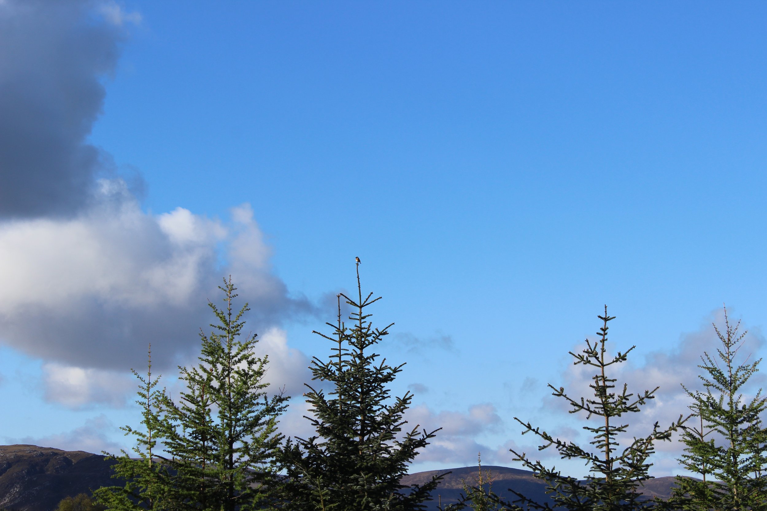
It is May, the sky was blue at 6am and the rest of the house was asleep so I took off with the camera. Here are some photos of a walk from the door to the edge of the plain.

looking up to Beinn dubh and beinn nan cailleach - bird song and blue skies

an Old pony track up to the Sealbhanaich by Allt an Lòin Uaignich (OS place name book - burn of the secret or lonesome morass)
Gocan-conaisg - (little attendant of the whin) - whinchat - ceilidhiche samhraidh - summer visitor

Canach

Flùr na gaoithe

Sòbhragan

A pine tree that may hold genetic information of the pine trees which grew here - the parent of a new forest?


Meall na Fuar Ghlaic, Beinn nan Cailleach, Càrn na h-Easgainn …

looking over to Càrn Dearg, Càrn Ruidhe Rèithe, Càrn na Sguabaig etc

Looking South from Creag an Dubhair / creag an tuathan towards the Monadh Liath

Loch Farr and Strathnairn
Today An Sealbhanaich is just another grouse moor and the only signs of human life there are traps of different sorts and butts. The wind farm turbines that Willie fought against are there. The Uisge Dubh has a private hydro now. A busy dusty forestry road runs through the woods below Creag nan Gobhar. Signs are in English and Polish. There are new large pylons following the Càrn na h-Innseag(/Innseig) road, the old droving route that takes you over the hills between Strathnairn and Strathdearn. Times change but, you can understand why Willie laments the rate and scale of these changes.
These names tell of other times and speak of human capacity, a diversity of habitat and wildlife, an awareness of conditions in the sky and underfoot, old beliefs maybe... This place had its own function. The people had purpose and a busy working life and spoke another language, Gaelic.
I’m glad to know there is a peaceful place just over the hill line. I can see Meall na Fuar Ghlaic from the door.
Here is a map done in a hurry with inks and tracing paper, a wee ode to the place and a way to get to know it. I could add other layers with the wind farm roads and turbines or little pockets of life that persist such as in the cut of Càrn Dubh Chromagach. A project that will roll on maybe …


the SHieling fold and the stone round house, top left here, are PHOTOGRAPHED in another blog - marches on the hinterland / a walk between two straths

caochan na buidheig - little blind streamlet of the buttercup / caochan na cloiche glaise - “ of the grey stone - see my other blog on caochain.
Here a satellite image of An Sealbhanaich.


gu deas bhon t-sealbhanaich aig bristeadh an latha - looking over the sealbhanaich at dawn

mullach càrn na h-easaginn / top of càrn na h-easgainn 2 photo credits: Alan Bellis
Notes: There is a Loch Sealbhanach in Glen Cannaich today. This loch was once called Loch Sealbhag - loch of the sorrel. Sealbhanach is given as the name of a farm nearby. It would seem that the farm name (with no translation given in the place name book) was later adopted as the loch name.
*Donald Campbell, Merchant, 57 in 1892 from Kingussie was very probably the son of Dòmhnall Phàil (Caimbeul) shepherd in Badenoch and author of “Duanag a’ Chìobair’ / Gu bheil mulad air m’inntinn o’n là thàinig mi’n tìr seo’ born in Dail an Spideal in 1798, died Kingussie 1875. MacTalla vol. 12 (1892-1904) makes mention of his son, Dòmhnall òg a merchant in Kingussie.
Credit to DASG Corpas na Gàidhlig, Digital Archive of Scottish Gaelic (DASG). University of Glasgow.
Here is Duanag a’ chìobair sung by a John MacMillain, Logierait from (1.20) on Tobair an Dualchais’s website. He gives a brief history of the author.